August 18, 2021: Rain, two lakes, one lock, a low bridge, and a ton of debris.
It was raining when we left Sylvan Beach at 6:25 AM the next morning. There was just enough of a breeze to make Oneida Lake a bit choppy.
Across Oneida Lake
Capt Paul was at the helm when we crossed the lake east to west (lengthwise). I sat up front in the watch seat. Together, we found each of the green buoys we had to follow to get safely across the lake.
Along the way, I tried to find the lights of two different ranges on the chart. One would guide boats into Oneida Lake East, a community on the north shore of the lake. The other would guide us into the channel at the far west end of the lake, where the Oneida River begins its westbound trip.
A range is a pair of markers, lighted or unlighted, that you line up with one behind the other. When they are properly lined up, you just keep them lined up to follow them in. In both cases here, there should have been lighted markers. I couldn’t find either one for Oneida Lake East. For the channel, we found one of the markers on the bridge where it should have been but the light wasn’t working. This is a theme I’ve noticed throughout our Erie Canal journey: navigation aids — including lights and buoys — are simply not well maintained.
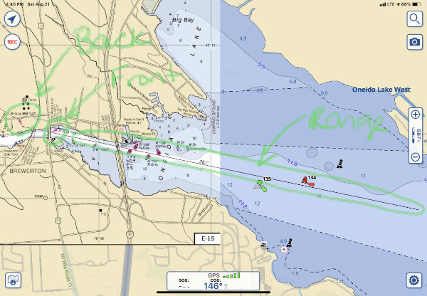
Here’s the range to the channel at the west end of the lake. There are supposed to be two lighted markers that, when lined up visually with one exactly in front of the other, give you a straight line approach to the channel from quite a distance out. They don’t work when you can’t see the range markers.
We eventually got to the west end of the lake and found the channel. This side of the lake was full of docks and marinas and boat. Of course, no one was moving except us. It was still before 8 AM on a rainy Wednesday morning; who would be out and about on a boat?
The Winding Path to Onondaga Lake
We had to keep our speed way down as we followed the path of the Oneida River westbound because there were just too many docks and boats. I’d already been yelled at once for making a wake in a no wake area; we were being extra careful to keep our speed down to about 5 knots so no one would get angry with us.
Not far from the lake, the Oneida River swept off to the right and the canal continued to the left. A sign made sure we didn’t take a wrong turn. That branch in the river turned out to be the first of several bends that the canal short-cutted; it rejoined the canal after Lock 23, which dropped us only 7 feet. The river would continue to loop away from us several times, with named cuts — the Morgan Cut and the Big Bend Cut — to keep the route short.
There were lots of homes along this part of the route and every one of them — or so it seemed — had its own dock with one or more boats floating on the water. When I took the helm, I found myself stuck at a frustrating 5 knots, inching my way past these docks to prevent (or at least minimize) wake.
Eventually, we got to Three Rivers Terminal where three rivers come together: the Oneida, the Oswego, and the Seneca. We continued left down the Sececa; the Oswego puts boaters in a different canal: the Oswego Canal to Lake Ontario.
More homes, more boats, more slow driving. Every time we’d reach a stretch of woods without homes, I’d raise the RPM to 3000 and the speed to nearly 10 knots. Then I’d see another home up ahead and I’d have to slow down and crawl past. My notes in the Cruising Guide say mostly Homes, Homes, Homes with a few Woods, Woods.
After a nice stretch of woods on both sides of the River, we reached the turnoff for Onondaga Lake. I made a left and turned over the controls to Dianne. With Capt Paul on watch, she guided us to the Onondaga Lake.
Onondaga Lake
Onondaga Lake is a much small lake to the southwest of Oneida Lake. Less than 5 miles long and a mile wide, it ends at Syracuse, NY, our destination for the day.
It was raining when we crossed the lake and I admit that I wasn’t paying very close attention. I was tired from being on watch and then from driving at no wake speed for so long. But when Dianne slowed down about a half hour after entering the lake, I came forward for a look. We’d reached the end of the lake but it was difficult to see the channel that would take us to the Syracuse Inner Harbor.
I was running Aqua Map on my iPad and it made the path pretty clear to me. Honestly, I think it does a better job showing where we are than Nano’s built-in Garmin system. (Shame on you Garmin. You are dropping the ball here.) I pointed out the railroad bridge we needed to go under. There was some confusion with another, higher bridge to the right. I told them I thought that bridge was to take car or pedestrian traffic over the train tracks. Right on cue, a train came, went over the trestle we had to go under and then under the taller bridge they’d been looking at.
So we headed for the trestle. Capt Paul took over. The area right before the bridge was full of floating debris and bracketed on either side by ancient wooden pilings sticking out of the lake. Paul navigated through the debris, between the pilings. Birds flew off.
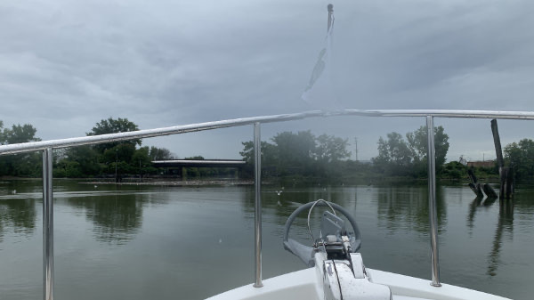
The debris field and ancient pilings outside the unmarked entrance to Syracuse’s Inner Harbor. No wonder no one goes there.
Then he steered us under the lowest bridge we’d gone under on the trip. The clearance was supposed to be 17 feet and we should have fit handily, but the VHF (radio) antenna scraped along the top of the bridge. Ouch!
Once past that, we found ourselves in a relatively wide channel filled with what looked like weak instant hot cocoa. I suspect it was just silty water. All kinds of debris floated in it, from tree branches to soda bottles. It was not a very appealing drive and it really kept you on your toes.
We passed under two higher bridges and found ourselves at the end of the channel, in the Syracuse Inner Harbor.
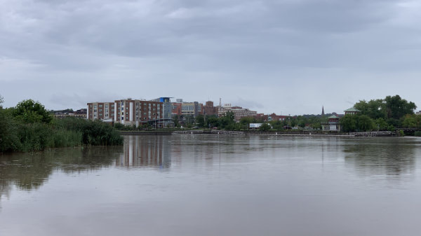
The Inner Harbor includes several wide fingers of land, a floating dock, an Aloft Hotel, and a creek feeding it with silty water.
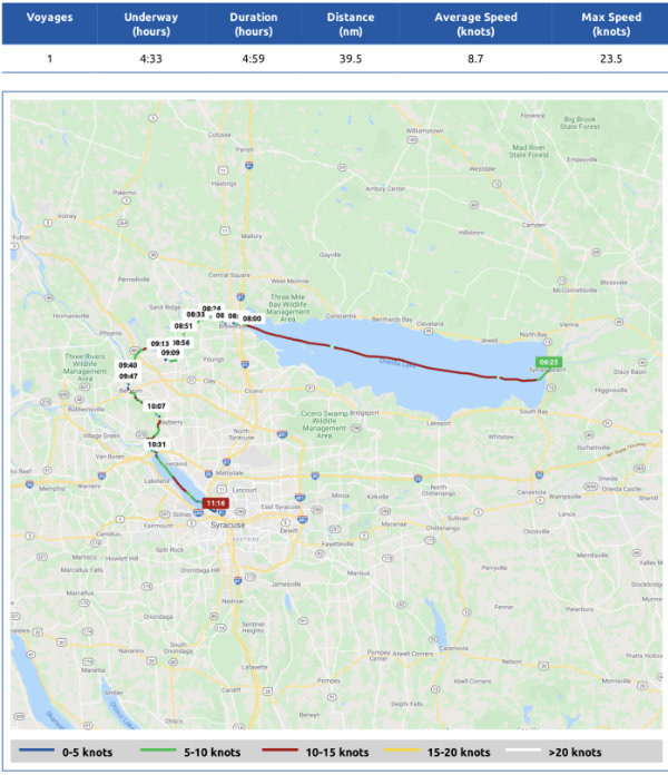
Here’s the Nebo log for Day 9 of my trip. You can follow us on the Nebo boating app; just look for Nano Paul G.
Syracuse’s Inner Harbor
Let me begin by sharing a passage from Waterway Guide about dockage in the area:
There are two marinas on the lake: the 90-slip Onondga lake Park Marina and the 30-slip Syracuse Inner Harbor Marina.
We were at the Syracuse Inner Harbor Marina. There wasn’t a single “slip” in sight. There was just a floating dock alongside the wall closest to the hotel. One boat was parked there. Kiosks did offer 30 amp power and water, but there was nothing else. Even the buidings at the far end of the harbor, which look like they may have been built for a marina office, were closed off and blocked with chain link fences.
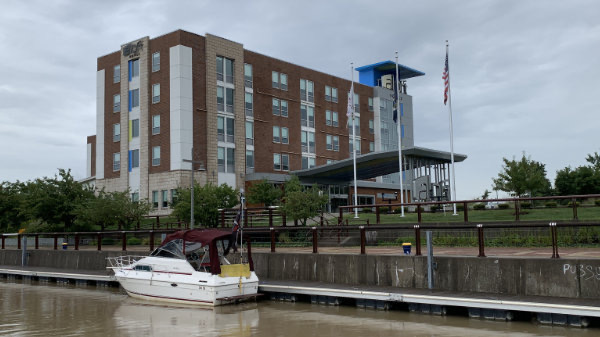
The dock at Syracuse Inner Harbor. That 30-slip marina simply does not exist and never has.
This was obviously a project that had never been completed.
This made sense. Capt Paul had tried calling and emailing every number and address he could find to get information about this facility. He never got a definitive answer about what was here. We were basically going in nearly blind, depending on satellite images from Google Maps.
What we found worked out okay for us. We tied up at the dock and plugged into power. Then we locked up the boat, grabbed our rain gear, and headed out for the Erie Canal Museum, with thoughts of lunch along the way.
Dinosaur BBQ and the Erie Canal Museum
We left the dock and headed through a commercial area with partially completed projects. Then an area of old industrial buildings that had obviously been converted into trendy offices or loft apartments.
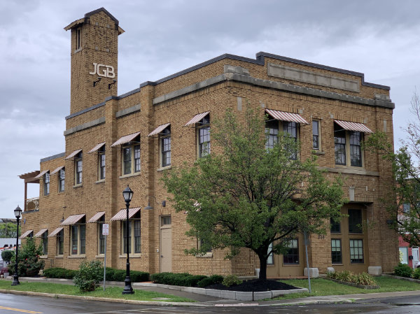
I had this office building pegged as an old firehouse when I saw the tower. Seeing where the two big doors had been on the front of the building confirmed my suspicions.
We made a few wrong turns, then found our way across a highway and into the Syracuse downtown.
I have to admit, I had very low expectations. The day before, Dianne had been reading aloud from the Internet and what she read made it sound as if Syracuse was a rundown city full of crime that even the State University college students hated. But what I was seeing wasn’t bad at all. I certainly didn’t see anything that would scare me off.
We came upon Dinosaur BBQ and the sheer smell of it reeled me in. Soon we were sitting inside at a big corner booth. The place was funky and played good classic rock and blues. And the food turned out to be amazing. Later, I’d wish I’d taken a half pound of brisket to go.
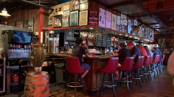
The bar at Dinosaur BBQ in Syracuse.
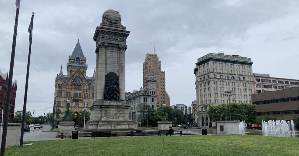
From lunch, we let Google lead us into downtown, past the spot where the original Erie Canal had actually passed through the middle of the city. There were many old buildings with impressive architecture, as well as a column with statues on two sides. A pond was the last remnant of the canal.
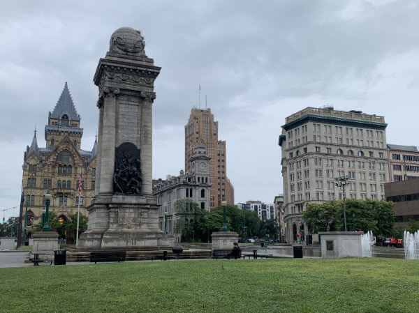
Downtown Syracuse was full of impressive old buildings.
and down a street to the Erie Canal Museum. By this time, it had begun drizzling, so it was nice to get out of the rain. We paid the $10 recommended donation and followed the arrows on the floor to begin our socially distanced tour of the exhibits.
The museum was informative, but, for some reason, I found it a bit boring. Maybe I was looking for more artifacts, photos, and maps. Or maybe I was just tired after being on the water every day for nearly a week and getting up at 5 AM. If you’re interested in the Erie Canal and are in Syracuse, you should definitely visit the museum, though. I think it’ll answer most questions you might have.
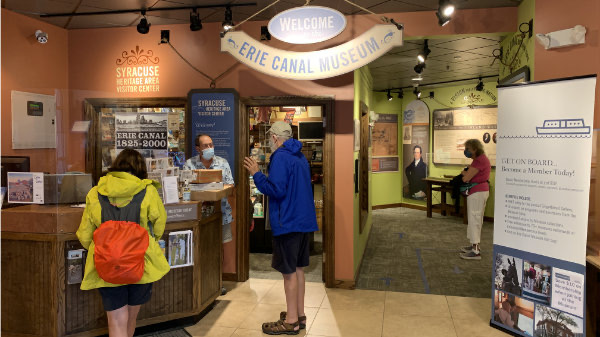
Here’s Capt Paul grilling the docent at the Erie Canal Museum. The man was full of information about the canal and museum.
We spent more than an hour there and then went down the street for coffee. We sat outside at a table right across from City Hall. For some reason, a bell system there started playing Smoke Gets In Your Eyes at about 3:10 PM.
By this time, it was raining pretty hard and I don’t think any of us wanted to walk all the way back to the marina — a distance of more than a mile. So I called an Uber. It came in about 10 minutes and had us back at the boat for $15.
At the Harbor
After relaxing for a while in Nano and workign on my Day 7 blog post, Capt Paul and I went on separate walks. He went to check out the fingers of land north of our dock and I went to check out the closed up buildings on the south end. I was hoping for a public bathroom out there, but I was very disappointed.
So I doubled back and went into the hotel lobby. No one challenged me as I walked past the front desk and found the lobby restrooms. After taking care of business, I thought about sitting at the bar for a drink, but it didn’t look very welcoming and I honestly didn’t feel like a drink. So I went back outside into the rain and walked back to Nano.
We spent the rest of the afternoon and evening on the boat, just relaxing. I’m pretty sure we were all asleep before 10 PM.
Hello! I’m very interested in the Great Loop and have loved your blog thus far. Thank you for sharing!
Thanks so much! I’m glad you like it and I’m very glad you took the time to comment. I need motivation and comments do the trick.