In this third part of a multi-part series, I explain how to break your Great Loop trip into chunks based on distance or time and roughly plan out each chunk.
Once you have your initial long-term plan, you should start thinking about how to break that plan up into more manageable pieces and begin planning the first one. I call this “medium term planning” because it’s not the whole plan I discuss in Part 1 and it’s not the week plan I discuss in Part 3. The goal of the medium term plan is to have a better idea of where you expect to be along the next section of the Loop based on where you want to go and the time you have available to get there.
Breaking Up the Big Plan into Chunks
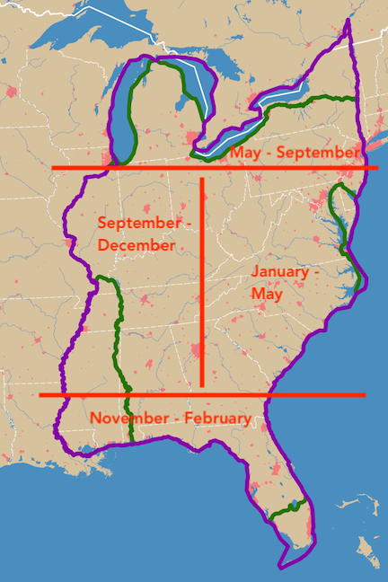
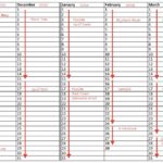
In this image from Part 1 of this series, I’ve suggested dates for various sections of the loop. (If you haven’t read Part 1, this might be a good time to do it.)
The way I see it, there are two ways to break up the whole plan:
- Time. When you break up the plan by time, you pick a few months where you expect to be in a certain area. This is a good way to do it if you have to leave your boat to take care of other responsibilities. (You did plan for those on your long term plan, right?) In the medium term plan I’m working on today, I have from today — January 21 is the day I wrote this — until about April 3 to get from Fort Pierce, FL to Chesapeake Bay. So I’ll plan that portion of my trip.
- Distance. When you break the plan up by distance, you pick the part of the loop you plan to be on. For example, you might pick the Inland Waterways from Chicago to Mobile as a section. Or maybe the Great Lakes as a section.
The map here actually offers a good basis for breaking your long term plan into four parts by either time or distance. Either way, both time and distance must figure into your plan since both have limits. Your long-term plan can also guide you. Remember, however, that as you start cruising, the rough time and distance estimates you made in your original plan will change. So a medium term plan you create halfway through your journey might not match what you originally planned on your long term plan.
When to Make Your Medium-Term Plan
It’s important to understand that you don’t make all of your medium-term plans at once. That was what you did with your long-term plan.
Instead, wait until a week or two before you’re ready to start that section of the Loop — so you’re sure about where you’ll be — and make a rough plan for the next few months or next big section as chunked out above.
The goal is not to drill down on your whole plan. Remember, that long term plan will change. Nothing is set in stone. So why do a lot of work for the entire plan when there’s a good chance half or more of it will need to be changed anyway? Just plan for what’s ahead of you, in the foreseeable time or distance.
Planning for Destinations Along the Way
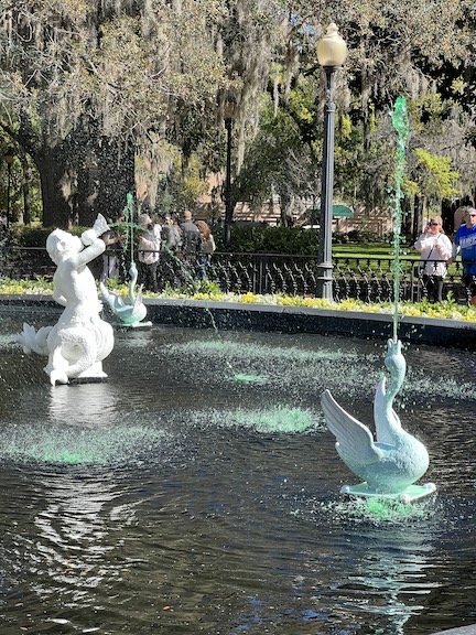
The fountain in Savannah’s Forsyth Park had green water for St. Patrick’s Day when I visited in March 2023.
The next step to creating your medium term plan is listing out all of the places you want to visit along the way.
By this time, you’ve probably done a lot of reading up on the places you’ll pass through. There are towns with shops and restaurants and great marinas. There are anchorages with access to parks and beaches. There are museums and lighthouses and a wide variety of other tourist attractions.
If you haven’t done your homework and have no idea where you want to stop along the way, this is the time to learn. Start with a map or chart and see what towns and cities are along the way. What’s there? Would any of them make a good stop?
There are numerous blogs (including this one) and books about other people’s Great Loop journeys. Check them out! But I urge you to use the information in them to build your own adventure and not to duplicate someone else’s.
Again, I have to recommend Waterway Guide because it covers the entire Great Loop route and has lots of up-to-date information. You’ll find their Going Ashore articles especially helpful to get ideas of what you can do at various stops.
The good news is, you only have to do your homework for one chunk of your journey during each planning session. While you might run across must-stop destinations for other parts of your trip as you do your research, jot them down elsewhere and try to focus on just the next part of your trip.
If you can, put these in the order in which you will arrive at them. This will make the next part of planning a lot easier. If you’re writing them down on paper, leave a space between each one.
For my plan, well, I’ve already covered the distance between Fort Pierce and Chesapeake Bay at least twice, so I know a bunch of places I’d like to revisit. What I need to do is find a few that I missed that I’d like to see. Here’s a partial list:
- Cocoa Village. Great anchorage and free dock. Lots of shops and restaurants. Good location to view rocket launches.
- New Smyrna Beach. Great downtown area. Museum. Shop that might buy my jewelry? (I’m a silversmith and am looking for shops to sell to.)
- Marineland. Cool, laid back little marina with ocean beach access.
-

If you stop at St. Augustine, be sure to visit the distillery and enjoy a craft cocktail at the Ice Plant, where they make perfectly clear spherical ice cubes.St. Augustine. Historic town with affordable marina. Good mail stop and place to prep the boat for continued travel.
- St. John’s River. 2-week side trip. Consult Nagui’s notes about individual destinations.
- Jacksonville. Visit with Kenny and Rhonda. See local sights. Reprovision.
- Fernandina Beach. Costly marina but nice town. Good for one night.
- Cumberland Island/Plum Orchard. Good quiet anchorage with shore access and hiking.
- Jekyll Island. Marina or anchorage. New to me; need to check it out.
- Fort Frederica Anchorage. Good quiet anchorage with shore access and hiking.
- Savanah. Thunderbolt Marina. Good stop for reprovisioning, etc. If Saturday, farmer’s market.
- Daufuskie Island. Day dock to get two more bottles of that excellent rum. Cannot arrive on Sunday. Anchorage for overnight.
- Beaufort, SC. Day dock for walk. Factory Creek anchorage overnight.
- South Fenwick State Park. Free dock, nearby anchorage. New to me. Or maybe B&B Seafood House dock?
- Charleston. Maybe. (I’ve been here three times already. Maybe time to skip it?)
-

If you like to “rough it” at anchorages — and who doesn’t? — you’ll probably love the beachcoming at Bull Island’s big, deserted beach.Capers & Bull Anchorage. Great spot on trip down. Empty beach, great beachcombing.
- Georgetown. Free day dock, then anchorage. Nice town with shops and restaurants.
- Barefoot Landing. Free day dock. Reprovisioning stop. Anchor at Bird Island north of there.
- Southport. Deep Point Marina, ferry to Bald Head Island to sell jewelry.
- Wilmington. Maybe. Check on overnight dock situation.
- Carolina Beach State Park. Excellent stop. Cheap, easy access to hiking, groceries, etc. Spend 4-7 nights.
- Wrightsville Beach. Anchorage. New to me.
- Beaufort, NC. Nice town. Up to two nights.
- Oriental. Free dock or marina. One night. Good for reprovisioning.
- Belhaven. Nice town. Free dock.
- Elizabeth City. Free dock. Gateway to Dismal Canal.
- Dismal Canal. At least two nights. Free docks.
- Portsmouth. Free dock. Restaurants, shopping.
- Hampton. New to me; booked last time. Make reservations in advance.
- Cape Charles. New to me.
- Roanoke. New to me.
- Tangier Island. New to me.
- Colton’s Point. Possibly end point for maintenance and one month dry storage.
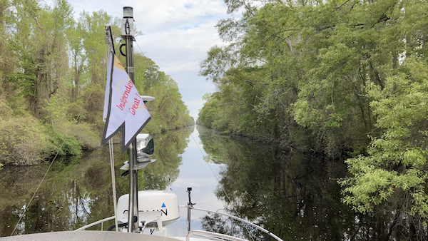
I absolutely adored the Dismal Canal and can’t wait to get back. (You can keep the crowds at Coinjock; the prime rib dinners are overrated. There. I said it.)
Note that for medium-term planning, I’ve only created a partial list of stops. These are the places I really want to stop, but it definitely does not include all the stops. I’ll drill down to get all the stops on my short-term plans.
Scheduling the Destinations in the Plan
Keeping in mind that this is still a rough plan and nothing is set in stone, you need to plot the destinations out on some sort of schedule so you know approximately when you’ll be someplace. To do this, you need to get an idea of how long it will take to get to each one. You should also have an idea of how long you think you might want to stay at each place. And if you must arrive at a place on a specific date or day of the week, you need to be sure to schedule it as needed.
For example, I’d like to — but don’t need to — get to Savanah, GA, on a Saturday so I can go to the Farmer’s Market. If that was very important to me, I’d make sure I included a Saturday morning during my stop in Savanah. Similarly, if I were attending a specific event that took place on a specific date, I’d put that on the schedule first and work around it.
To get an idea of how long it will take to get from one place to the next, you need three pieces of information:
- The distance between the points. If you’re on the ICW, that’s pretty easy: just use mile marker numbers, remembering that these are in statute (not nautical) miles. (For distances under 50 miles, the difference between the two is minor; 1 NM = 1.15 SM.) You can also estimate using the scale of the chart or map you’re working with.
- Your cruising speed. Obviously, the faster you cruise, the quicker you can get from point A to point B. Just keep in mind that certain parts of the loop — I’m thinking of South Florida on the AICW — have lots of bridges and minimum/no wake zones. Those will definitely slow you down, even if you’re already cruising at a slow speed.
- The amount of time you like to spend cruising each day. Some people just want to cruise for a few hours. Others don’t mind cruising all day.
When I make my medium term plan, I put down the estimated distance between points on my list in the space between the points. So, for example, the distance between Thunderbolt Marina near Savanah (my preferred stop in that area; MM 583.2) and the dock I want to stop at at Daufuskie Island (MM 567.4) is just 15.8 miles. I know I can easily cover that in a day.
My cruising speed is a little weird. My boat has two cruising speeds, which I refer to as slow cruise and fast cruise. Why two? Well, the design of my boat makes it almost as efficient at 3000 RPM (14-16 knots) as it is at 2200 RPM (7-9 knots). So I cruise at a speed that varies depending on how quickly I want to arrive. If I had just 15.8 SM to travel in a day, I’d likely do a slow cruise — why rush? But if I need to cross a large, sort of choppy body of water or cover more distance in a day, I’ll do a fast cruise. Or I’ll combine the two.
As for how much time I like to cruise in a day, I like to limit it to 4 or 5 hours. Much more than that and I become exhausted. If you have two folks on board to share the driving, you might not mind cruising for longer periods of time.
With all this information, you should be able to fill in a schedule with your desired stops and the amount of time you plan to spend at each. You’ll fill in the gaps between those stops later. For example, if you expect it to take four cruising days to get from Demopolis, AL to Mobile, AL, leave that 3-night gap on your schedule. You’ll fill it in when you do your short term plan or as you get recommendations and suggestions from other Loopers. (The jury seems to be out on Bobby’s Fish Camp.)
It’s Not Set In Stone!
I cannot say this enough.
Isn’t it nice to visit a website that isn’t plastered with advertising or sponsor messages? Or trying to get you to buy merchandise or sign up for seminars? If you appreciate the (mostly) ad-free experience, how about buying me a cup of coffee to thank me?
Whatever you plan, even at this stage, will change. You might hear about other places you want to stay — or be warned away from places you thought you might want to stay. Weather can be a huge factor. Last year I was stuck in Orange Beach, AL for a week due to a severe cold front and then stuck in Steinhatchee, FL for another week due to high winds on the Gulf of Mexico. (I was almost stuck in Demopolis for five extra days because of flooding but made the dubious decision to press on anyway; read about that here.) Sometimes you can’t get a reservation at a marina you want to stay at until three days later than you wanted to be there. Or a late season hurricane has wiped out a town where you planned to spend a week. Or you develop a stomach bug that has you staying close to a toilet for four days. These situations will have a rippling effect on your plans that you will tackle when you do your short term planning.
None of your plans are set in stone and, over time, you will learn through experience how to deal with that. It’s part of the challenge of the journey, it’s part of what makes the Great Loop an adventure!
—
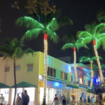
Want a challenge? All the photos that appear in this post were shot along the Great Loop within the past year, including the one in the header image. If you know where I shot that photo, be the first to tell everyone else in the comments. Bonus points if you know the name of the anchorage. (And yes, that’s a hint.)
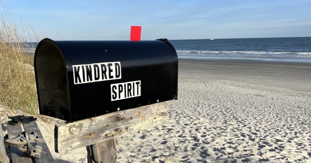

The Kindred Spirit mailbox is on Bird Island! We were there on our Loop in April, 2022. When we arrived, the anchorage was packed with day-boaters. We were a little leery of sticking around with the crowd, but by sunset we had the place to ourselves. There was a dolphin near our boat that evening that had no fear of us and hung out near the boat for a long time.
I also loved the Dismal Swamp, though the weather lived up to the name: it was so stinkin’ hot! We stopped at the welcome center overnight and went for a walk in the park the next morning. A park ranger records the names of people who go into the park to make sure everyone is accounted for before they lift the bridge over the river each evening, limiting access to the park exit. We asked what would happen if we got “stuck” in the park overnight. He said, “Well, I don’t think you’ll *die*, but I’m sure you won’t sleep.” That was incentive enough for us to make sure we got out on time. The park was very loud at night from animal sounds.
One thing I like about the stretch you’re describing is that there are so many places to stop. We liked Eau Gallie; Port Canaveral; St. Augustine (one of my Top 10 stops, I think.); Brunswick, GA; Jericho Creek, SC (there are old rice fields nearby. My husband took the dinghy on a little field trip and loved it); Beaufort, NC; Oriental, NC; Alligator River, NC; Yorktown, VA (another Top 10). We didn’t spend as much time in the Chesapeake as we would have liked. There’s so much to explore there! For me, the planning is as fun as the actual doing.
Thanks for all this great input! I’m sure other folks planning their trip will get a lot from it.
Our trip to Bird Island included an incident (my fault) where I thought we could walk around the south end of the island and up to where our dinghy was parked. It did not go well. We had a lot of deep, sticky mud and flies to deal with. We should have either dinghied around to the south end (which is what I’ll likely do if I stop there again) or retraced our steps on the trail and then off it. The anchorage was packed overnight with sailboats. We were the farthest north because I could handle the shallowest water.
It was April when I went through the Dismal Swamp last year and I suspect I’ll do it in March this year. Not hot and not buggy (yet). Also probably not crowded. I tend to stay ahead of the pack whenever possible, but southbound this autumn I traveled among a lot of snowbirds. I think that where I am right now is ahead of the Looper pack, although I know there are some Loopers ahead of me.
I’ll try to check out Yorktown VA this time as I go through Chesapeake Bay. I’ve got some other recommendations, too. But that’ll likely be after my trip home in April and will likely put me in the middle of the Looper pack. We’ll see.