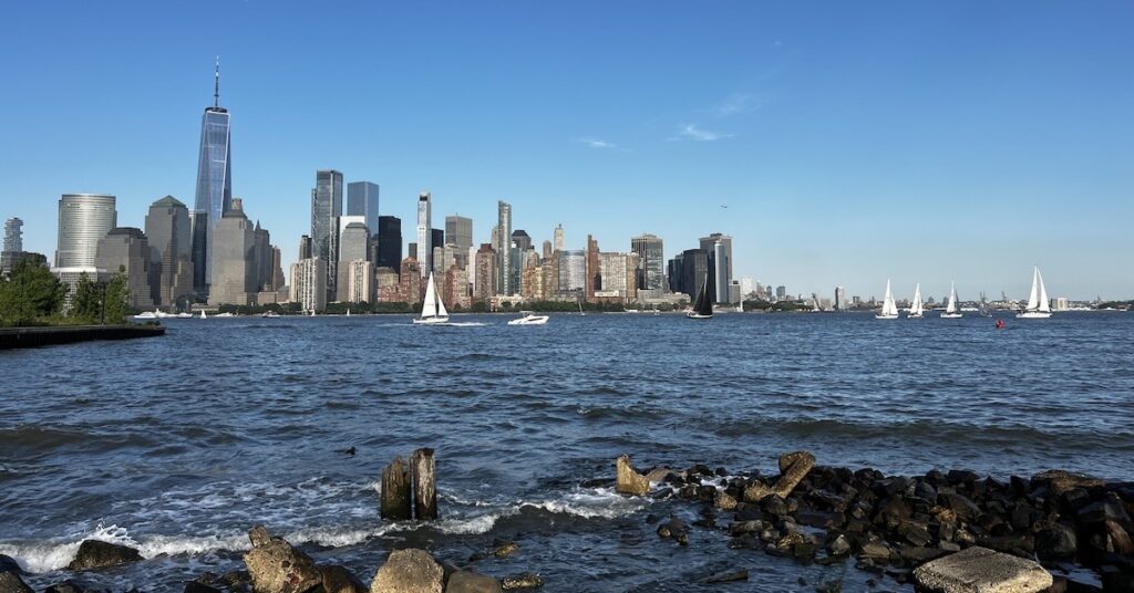
May 21, 2024: I leave the Atlantic Ocean behind me and cruise into the familiar waters of New York’s Upper Bay.
No doubt about it: my trip up the coast of New Jersey to New York’s Lower Bay was probably my least favorite (so far?) of my Great Loop journey. I dealt with rolling ocean waves and sick dogs on the three-hour cruise from Cape May to Atlantic City. Then six hours of cruising on the New Jersey Intracoastal Waterway in high alert mode, watching out for shallow water and idiot fishermen fishing in the narrow channel. And finally another four hours of rolling ocean waves to get me to the Lower Bay, where I dropped anchor at an anchorage recommended by my friends LeaAnne and Bruce on New Bearings.
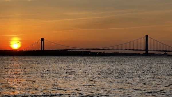
The best part of the anchorage was probably the incredible sunset beside the Verrazano Narrows Bridge.
And that’s where I was on the morning of May 21, 2024: Anchored only a few hundred feet from a Brooklyn beach in relatively sheltered water, wondering if the last 10 or so miles of my trip to New York would be as rough as the previous day.
Spoiler alert: It wasn’t.
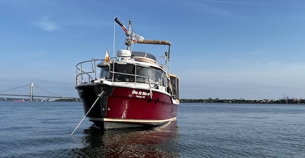
Here’s Do It Now anchored at Gravesend Bay. You can see the bridge on one side of the boat and the skyscrapers of lower Manhattan on the other side, off in the distance.
Passing Through the Narrows
I shot video of my entire trip from the anchorage to the marina in Jersey City, but when I started to edit it, I became doubtful that anyone would want to watch it. So it’s sitting unedited, waiting for a rainy day. If you want to see it, speak up! Leave a comment on this post.
I weighed anchor and headed out at around 8:15 AM, after one last run on the beach for my pups. My path took me through an anchor field where one barge and tugboat had been anchored overnight and into the main channel. I was running at about the same speed as a tug pushing a barge so I maneuvered behind it and wound up passing on its port side. That’s when I started to notice — and avoid — the high speed ferries coming up the bay and passing under the bridge. It was certainly not the kind of place to let your attention wander.
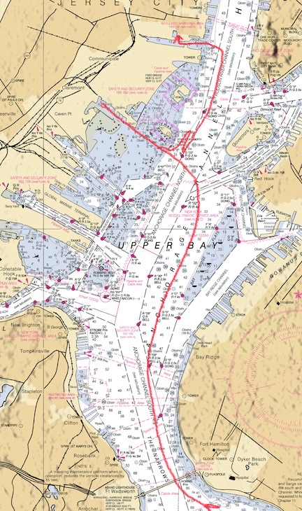
New York City’s Upper Bay as it appears in a raster chart. I’ve traced my route into and through the area in red.
The bay was remarkably calm that morning — a huge contrast from the day before. I passed under the Verrazano Narrows Bridge, now ahead of the tow, and headed toward another big and nearly empty anchoring field. My logic was that large commercial boats, including ferries, would stick to the channels. It worked. For a while, I didn’t have to worry about any other traffic.
The Statue of Liberty and Its Anchorages
I had a problem. It was early in the morning — still only around 9 AM — and I was the only pleasure craft in the area. I wanted a photo of my boat in front of the Statue of Liberty, which I could clearly see off my port bow. I couldn’t get that picture if I didn’t have a buddy boat to take that picture.
The other problem was that I was way too early in the area to check into my marina in Jersey City. So I had to kill time. I decided to do that by checking out the anchorage on the other side of the Bay, behind the Statue of Liberty. I’d originally planned to stay there and had made other plans. But I was still curious about it, eager to see if it was the kind of place I might want to stay in the future.
So I crossed the Bay and entered the channel just south of the Statue.
I should mention here that the conditions, including lighting, was perfect. The statue faces southeast, toward the entrance to the bay. The sun rose in the northeast only a few hours before and was fully illuminating the front of the statue. The air was clear and crisp with very little of the usual New York City haze. It was a near perfect day.
I snapped a few photos as I passed, then reduced speed and cruised west down the narrow channel.
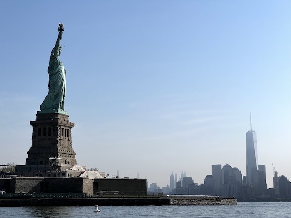
I shot this photo out the window of my boat as I cruised west past the statue.
Although there’s an anchorage right behind the statue and a few sailboats were anchored there, the one that interested me was adjacent to a boat ramp at Liberty State Park in Jersey City. Remember, when I anchor out, I need to do it in a place with easy access to land via dinghy to walk my dogs. Boat ramps and beaches are my two favorite access points. This anchorage, which was in a very sheltered basin with about seven anchored sailboats, had both.
Okay, I’d killed about 15 minutes. Now I needed to either find someone to take my picture or go to the marina and hope they’d let me in.
The Photo Shoot
I got on Nebo. Nebo is an app a lot of Great Loop Cruisers use to keep track of friends in other boats they meet along the way. I looked at the map to see if anyone was coming. Sure enough, a boat named Odyssee I was heading north, just crossing under the Verrazano Narrows Bridge. I used the chat feature in Nebo to send them a message.
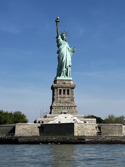
This photo of the Statue of Liberty shot from my boat is so good (IMHO) that it’s almost surreal to me.
And I waited.
And waited.
In the meantime, I’d come out of the channel and was in front of the statue, just beyond the buoys set in place to keep you from getting too close. (The statue is in a restricted area, which is why I didn’t even bother trying to fly my drone to get the shot.) I was getting tossed around by the wake churned up by tour boats taking sightseers from lower Manhattan to the statue. I took pictures, of course. I had a perfect view of the statue.
And then the folks in Odyssee I responded. Yes, they could take my picture. Could I take theirs? Of course! We made a plan: I’d get into position and they’d shoot me first and then we’d switch places and I’d shoot them. I had the buddy boat I needed!
By that time, I could see them coming. Soon they were in position and I was getting instructions from Louis on Channel 17. He shot photos and videos. I moved carefully, dodging the aggressive tour boat drivers. We switched places. We did the same routine, now with him doing the dodging. A bunch of folks on jetskis showed up. Other boats. It was getting a little crazy.
And then we were done.
We exchanged the best photos the same day. Paula and Louis sent me the rest a few days later and I sent them the rest a few days after that. (I had a bunch of bad cell signal marinas.) It was great to get the trophy shot I wanted.
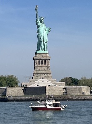
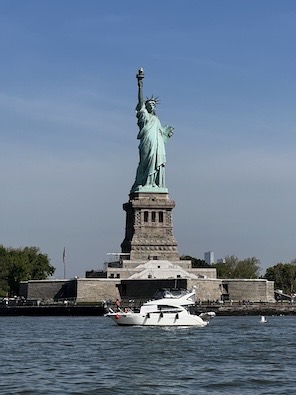
Here are the two best shots of our photo shoot. Typical Looper trophies!
Checking in at Hudson Point
I’d had enough of that area and headed north as soon as we were finished. Odyssee I fell in behind me. I was going to Hudson Point Marina where I’d booked a slip for two nights. They were going to Liberty Landing to fuel and do a grocery run before continuing upriver to Half Moon Bay.
I was able to check into my slip at 10 AM, which I really appreciated. I was hungry and planning a lunch in Chinatown. I squeezed down a narrow fairway and backed my boat into a slip that I honestly didn’t think I’d fit into.
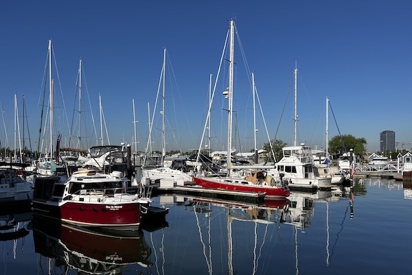
My slip was in the sheltered basin of Hudson Point Marina.
Over the next few days, I’d visit Manhattan twice and then take some old friends for a trip I’d done many times as a child: a cruise around Manhattan Island. But that’s another story.
