January 2-3, 2024: We zip from Key West to Key Largo with one makeshift anchorage and a tourist stop along the way.
Tuesday was a nice day with light winds and sunny skies. We left Key West pretty much the way I’d come in just three days before, following the channel out into Hawk Passage. We all sat up on the command bridge to enjoy the sun, but it was a lot cooler than we expected so we wound up moving downstairs after about an hour. It was a lot warmer inside. I love driving from up on the command bridge, but I also like being comfortable.
Cruising to Marathon
Our goal was to anchor in Sisters Creek just outside of Boot Key Harbor at Marathon. We put the pedal to the metal (so to speak) and cruised at 3000 RPM, getting 12 to 14 knots. The channel’s waters were relatively smooth so it was an easy cruise. The only challenge was dodging the crab traps, which we had become very good at.
Not far from 7 Mile Bridge, we noticed two large, fast boats coming up behind us on our port side. One of them was on AIS and we recognized its name as the companion boat of our very loud neighbors at Galleon Marina in Key West. I steered us to starboard so they wouldn’t pass as closely as they were lined up to pass; I hate being waked by assholes who have a huge open channel and have to drive at top speed 50 feet off my beam. I wound up putting about a quarter mile between us before they passed, almost in formation. Their wake was still rough and I had to steer into it to avoid everything being tossed around inside the cabin. They eventually crossed in front of us and passed under 7 Mile Bridge’s main channel. There’s a channel there that cuts north to the west side of the Florida peninsula, and I recall the loud boat people being from Fort Meyers. I wondered if they’d get all the way home that day, but it seemed unlikely given that it was already well after 3 PM when they passed us.
Because I don’t like to pass up a chance for cheap fuel, we stopped again at Safe Harbor Marathon where we put 70 gallons of diesel on board at just over $4/gallon. I also took the opportunity to walk my pups and use the restroom. I saw the Ranger Tug folks I’d met on my stay the previous weekend and they called over to ask how Key West was. “Crazy,” I replied.
Anchoring at Sisters Creek
From the marina, we headed through Boot Key Harbor toward Sisters Creek. Apparently, there are 60 people on the waiting list for a mooring ball in the harbor — I got that tidbit of information from a dockhand at Galleon Marina that morning — and a bunch of them were anchored exactly where we were going at a bend in Sisters Creek.
Sisters Creek runs from the harbor to Hawk Channel. It’s a winding waterway through thick mangroves. The anchorage there is set up for “Mediterranean anchoring”: that’s where you drop anchor, back into the mangroves, and tie your stern to the trees. It prevents the boat from swinging with the current and wind and allows more boats to park in a confined space. The area was already pretty packed with more than a dozen boats there. We tried three times to park at the end of the row, but the current was a lot stronger than my boat’s stern thruster could fight against and we couldn’t get the stern into the trees.
We gave up and continued down the creek, eventually getting back into Hawk Channel. It was getting late and the sun would be setting in an hour or so and we really had no idea where to go. I found myself getting “anchor stress” again.
We chatted on the radio with a sailing cat heading into the creek from the channel; they wanted to know about creek depths. There was plenty of water in the creek. After we told them we’d be anchoring out off Hawk Channel somewhere, I changed my mind, turned around, and headed back into the creek.
We wound up dropping anchor not far from the mouth of the creek and using a rope to tie us to the mangroves and a stern anchor to keep us from swinging into the trees when the tide changed. It was a fugly setup, but it worked; I don’t think we moved more than 3 feet during our stay. The sailing cat did a similar parking maneuver about 100 yards farther up the creek.
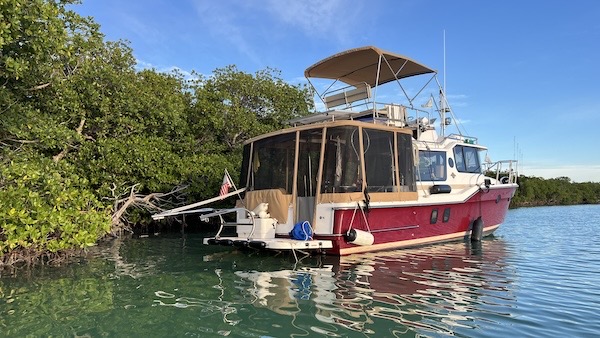
Here’s how we parked at Sisters Creek. Anchor in front and second anchor on the starboard stern, line tied to the trees on the port stern. We didn’t budge all night.
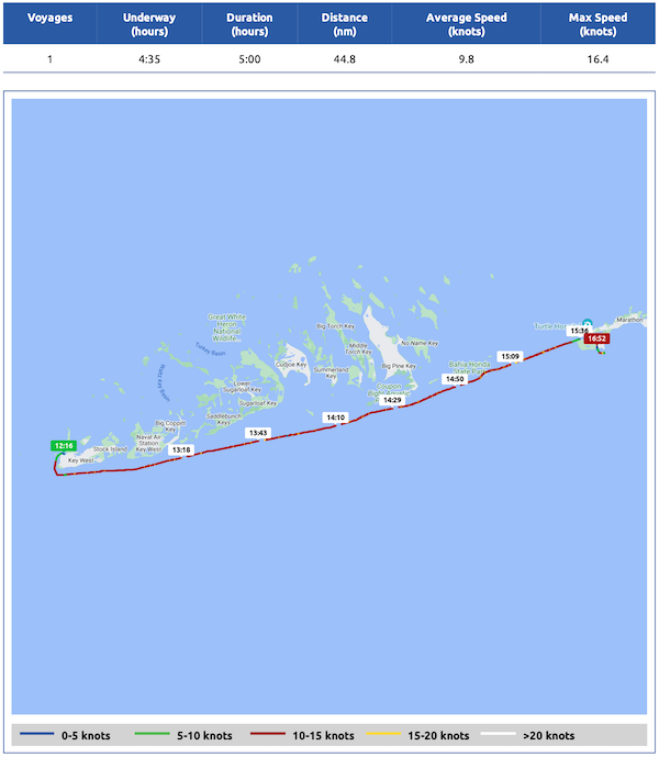
Here’s my Nebo log for January 2, 2024. Download a PDF log file with more info. Track Do It Now on Nebo.
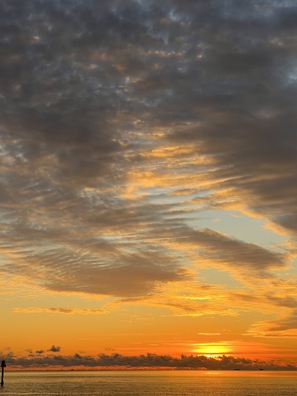
Sunset from Sombrero Beach.
The best part about this anchorage was the publicly accessible Sombrero Beach at the mouth of the creek. It was a short dinghy ride away. We loaded up the pups and got there in time for sunset. There was a couple getting married on the beach with a small group of friends and family members on folding chairs. We slipped past them and walked barefoot on ancient coral to watch the sun slip into the ocean, much as we’d done the evening before in Key West. But somehow this was infinitely better — no drunks, no crowds, no silly applause.

We saw this bird perched on branches just a few feet away from the boat when we got up in the morning.
Back at the boat, I grilled up some pork chops for dinner. We had them with reheated brussels sprouts that I’d made and hadn’t eaten a few days before. We spent the evening watching a Modern Marvels documentary about the construction of the Overseas Highway from Key Largo to Key West. I kept falling asleep.
On to Indian Key
I had a great night sleep in quiet conditions with hardly any boat motion. We took the pups to Sombrero Beach for their morning walk. There were very few people there and a few of them had friendly dogs also running round off leash. The girls had a good run. We watched the sunrise before returning to the boat for breakfast and to prep for departure.
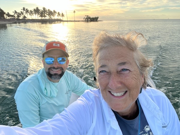
I shot this photo of Jason and myself on our way back from watching the sunrise with my pups at Sombrero Beach that morning.
We left the anchorage at about 9 AM. It was a rough start in Hawk Channel, with wind out of the northeast chopping up the water. But the farther we drove, the calmer it got. We cruised at Get-There speed (12 to 15 knots).
It wasn’t long before we had Indian Key in sight. Jason had found Indian Key on a chart and we’d considered it as a possible overnight anchorage. It had mooring balls on the southeast side and the reviews had mixed opinions on whether it was easy to get to shore. All the reviews mentioned the trails around the island and the remains of the settlement there. We figured it might be a good place to stop and check out, especially since the conditions were so calm and it looked easy enough to get to shore on a rocky beach we could see from the mooring balls.
Jason drove while I picked up the mooring ball. It took me two tries. I’m accustomed to mooring balls with rings on top that you connect to, but the ones on the east coast have “pennants” — long floating lines that run from the ball and have a loop at the end. You’re supposed to attach to that loop and that takes a different technique than I’m used to. This one had the longest pennant I’d ever seen. But I got it on the second try and secured Do It Now to the ball.
At Indian Key
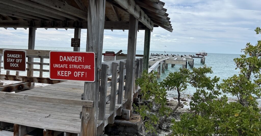
We loaded the girls into the dinghy and went ashore. The beach was old coral rock and very rough, with lots of holes. It was tricky getting the boat in without dinging the prop on the motor. Jason tied the dinghy to a rock and we walked up onto the island. It was heavily treed and the dock near where we’d brought the boat was severely damaged and covered with signs warning people to stay away. We eventually found a path beyond where a bike rack had been used to place a barrier between the dock and the trail system.
We spent about an hour walking around the island, reading interpretive signs at building foundations and piles of rocks that had been buildings. Apparently, Indian Key had been settled by a community of shipwreck scavengers who would race out to shipwrecks along the reefs to help save lives, offload cargo, and try to refloat ships. You can learn more about the history of the place here. Now there are just paths where roads might have been and ruins where buildings had been. Some building sites are completely gone. The island gets its name from the fact that it was attacked by Indians who ultimately destroyed the buildings and either drove off or killed the settlers.
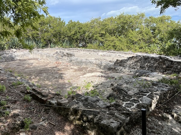
One of the larger ruins at Indian Key. There really isn’t much of anything left there.
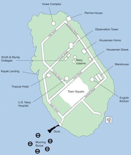
Map of Indian Key. Download a park brochure here.
We walked around the entire island — it’s very small — and my pups got a good chance to run. (Yes, the island is signed “No Dogs” — this is Florida, after all — but we’d already brought them with us and I wasn’t about to leave them in the dinghy. I kept them close and cleaned up after them. If more people were responsible for their dogs, there wouldn’t be so many “No Dogs” signs.) I took note of the kayak landing, which really wasn’t far from where we landed with the dinghy. I was also amazed by the quantity of broken coral all around the edges of the island.
On to Key Largo
By the time we returned to the boat, the weather had changed. The wind had whipped up and so had the waves. We dinghied back to the boat in a heavy chop. We stowed the dingy, dropped the mooring ball, and got under way again, now battling two to three foot waves off our starboard bow. We had 20 miles to go to get to Key Largo. Jason, at the helm, set the throttle to 3000 RPM for our Get-There speed, but we were barely able to keep 13 knots most of the way as we fought the wind and waves. It wasn’t the worst I’d been in — heck, I’d been in a lot worse on my bad day the previous week — but it was tiring and I think it really wore down Jason.
Eventually, we reached the channel that would take us to Largo Sound. We turned in gratefully and cut speed when we reached the first Minimum Wake marker. That put us in a narrow and very calm channel that wound through mangrove trees. I made radio calls on the two “dangerous” blind curves we encountered. Some fishing boats passed us when we were going at minimum wake speed in an area that didn’t require it. (Oh, well.)
The channel ended in a large, rectangular body of water. We maneuvered toward the mooring balls. No one answered on the radio, so I called the park. They told me to tie up to any ball, so we picked the one closest to where we thought the marina was. This time, Jason grabbed the pennant on the ball. He got it on the first try.
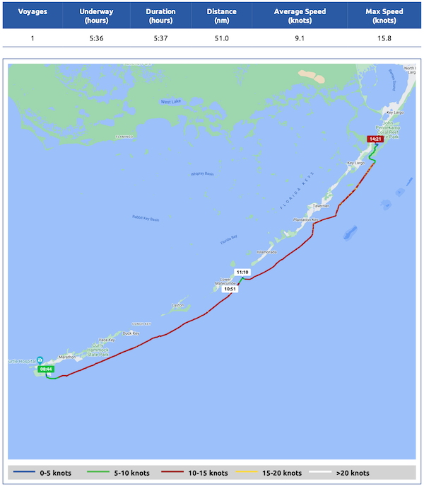
Here’s my Nebo log for January 3, 2024. Download a PDF log file with more info. Track Do It Now on Nebo.
Keep me caffeinated so I write more!
We settled in for what would be four nights at Key Largo’s John Pennekamp State Park, where we hoped to be sheltered from Florida’s next big winter blow.
Look at you, practically all caught up!
Except for those huge, glaring gaps! LOL.
I’m interested in your dinghy setup. We have an R31 CB and out 9 foot aluminum rib + 15hp Honda are too heavy to be lifted on our davits. I see your dinghy is on some sort of a pivoting system…can you share the make and model? We doing the Downeast Loop this summer and I would hate to tow the dinghy all the way…LOVE the blog…its giving us loads of tips for our loop.
My dinghy davit was a game changer for me. I travel with dogs so going to land when anchoring out is a must. The Weaver davit setup with the motor mounted on the back rail was a royal pain in the butt.
This is an Olssen Manufacturing davit. They’re based in the Seattle area but they shipped it to the marina where my boat was summering (in Maryland) and the staff there installed it. Total cost was about $4K with installation and custom parts, as well as the removal of my Weaver davit and swim platform rails. I figure that I will save that amount in less than a year of cruising considering that marinas cost an average of $100/night and I now anchor out 4-5 nights a week. (I was rarely anchoring out prior to the davit because of the hassle of launching the dinghy.)
Call Josh Watkins at 206-767-0505. I’d love it if you told him I sent you, but you don’t have to. I don’t get any sort of commission or anything, but I would like him to know how happy I am with it. If you tell him you heard from me, he’ll know exactly which davit it is. They make a nicer davit that’s more costly; I’ve seen it on a friend’s R31. This one is good enough for me, although there are weight constraints, so know how much your setup weighs before calling. Good luck and please do let me know how you do.
Also, I’ll likely blog about this one day soon and include some good photos.
Do you have to remove your outboard before raining it? This was my worry. Mine weighs about 100 lbs so I could not safely lift it myself….I would need to install another engine lift and bracket if I went with the Weaver system
RAISING it….
Another option was to use my existing davit system, leave my gas outboard at home and buy an electric….Torqueedo or other. With that setup I could easily remove the engine and stow it in a lazarette…then lift the inflatable high enough to clear the prop wash…which is fairly significant when pushing the boat hard…..surprised, actually, that Ranger hasn’t done anything to address the drag created by the swim platform…
I’ve noticed that ALL Ranger Tugs seem to ride low in back. And yes, when you get up to 3000+ RPM and the nose comes up, the swim platform definitely has some drag.
I think the stern low attitude could be fixed by replacing the current anchor setup (with 50 feet of chain) to more chain, like at least 100 feet. I’m just not willing to make that investment or add that amount of weight to the boat.
I do have a portable generator stowed under the aft deck. I figure it weighs 60-80 pounds. I’m hoping to remove it in the spring when I drive home. I don’t want to sell it and it’s too costly to ship home.
I do want to add that if you like to cover long distances with your dinghy, check the range of any electric motor you buy. I went with gas because my experiences with electric were decidedly unimpressive.