December 19-26, 2023: I spend 7 days in a row at anchor in south Florida with mixed results.
Mid December found me in the southern half of Florida on the ICW heading south with my friend and temporary co-Captain, Jason. We’d stopped for about a week at my Dad’s house in Fort Pierce — he has a dock in his backyard — but we continued on our way on Sunday, December 10 with the goal of getting Jason to Fort Lauderdale by December 16 to catch a flight home for the holidays.
Weather Sends Us Backwards
We’d been watching the weather, of course, but I seldom believe forecasts more than a few days out.
We stopped at two anchorages on our way south: Sunday night at Nettles Beach (not recommended) and Monday night at Peck Lake (recommended; see below). The wind was howling on Tuesday morning when I woke up and I checked the weather again. The forecast had gotten worse. South Florida was in for one hell of a wind storm with rain a definite possibility.
After checking availability at a half dozen marinas in the Fort Lauderdale — one of which wanted $15/foot to tie up at its fuel dock — there was only one logical thing to do: go back to my Dad’s house to wait out the storm and drive Jason to Fort Lauderdale on Saturday for his flight.
So that’s what we did.
We made it back to Fort Pierce from Peck Lake in just a few hours. I pushed my boat hard, cruising at 80-90% RPM to get 14 to 16 knots, depending on tidal currents. The ICW there is on the wide Indian River for most of the way and it was very choppy, with wind out of the north. My boat cut right through it, burning lots of dinosaurs all the way. I didn’t care. I just wanted to dock somewhere calm again.
We tied up and plugged in to my Dad’s 20 amp household current connection. (For some reason, he didn’t want me to upgrade it to a 30 amp boat outlet, even though he has 30 amp power at his unused lift.) We spent a few days with Jason working from the boat as usual and me getting what I can only assume was food poisoning after eating at a Panera. That took me down for two full days. When I was recovered, it was time to take Jason to Fort Lauderdale.
The weather got considerably worse after Jason left, bouncing my boat around in the very sheltered canal where I was securely tied. I could only imagine what it would have been like at an anchorage.
I wound up staying until Tuesday morning. By that time, the storm was terrorizing New England, dumping tons of rain on places that couldn’t handle it.
Four Anchorages in Seven Days
I headed out on Tuesday morning, stopping for fuel and a pumpout at the excellent Safe Harbor Harbortown in Fort Pierce. Decent fuel price, great service, and the restaurant is good, too, although I didn’t eat there that day. My destination was Peck Lake about 30 miles away. I knew it was a good stop and I knew exactly where to park for the most shelter and easy access to a beach for my pups.
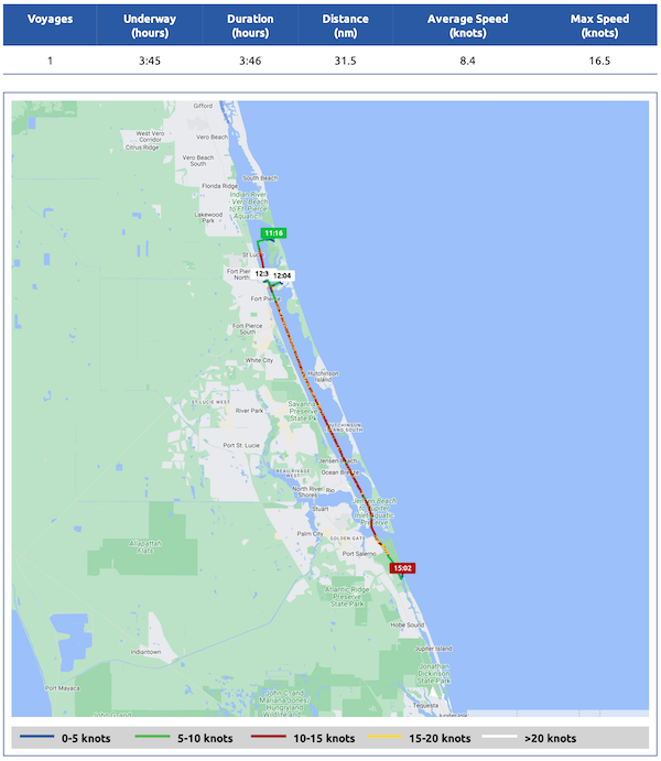
Here’s my Nebo log for December 19, 2023. Download a PDF log file with more info. Track Do It Now on Nebo.
Although the weather wasn’t bad, it wasn’t good either. Wind was out of the east, which was fine for Peck Lake, especially where I was parked so close to Jupiter Island. One night turned into two nights which turned into three nights. There’s something comforting about an anchorage you know well and I got to know Peck Lake very well over the three days I was there.
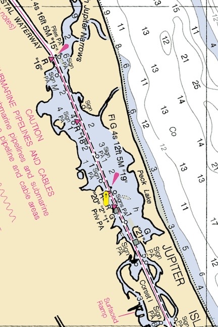
Peck Lake on a standard raster chart. Jupiter Island is very narrow there.
Let me describe it. It’s basically a long cove tucked against a barrier island east of the ICW. You have to enter after the green buoy (southbound) and then cut northeast bound to stay out of shallow water. I had already been pretty close to the island on our previous stay so that’s where I went again. Although there were more boats there than when we’d been there the previous week — at least 30 of them — “my spot” was available. So that’s where I parked.
From there, it was a short dinghy ride to the barrier island. So short, I should mention, that I actually rowed it a few times just for the exercise. There’s a small beach there that gets smaller at high tide. There’s also a path that cuts across the island to the ocean beach, which is pretty much deserted. My pups and I made the trip over there three times a day.
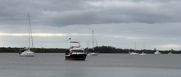
Here’s Do It Now among the mostly sailboats at Peck Lake.
The ocean was angry that week and I found a few useful items washed ashore: a small fender that might be useful for my dinghy and a string of three styrofoam floats that would work well on my crab trap. I also found lots of shells and trash. I actually filled a dog poop bag with small plastic items on one walk there with my pups. (I’ve begun collecting plastic shopping bags for future beach walks. Someone has to pick up the crap that washes ashore and it may as well be me.)
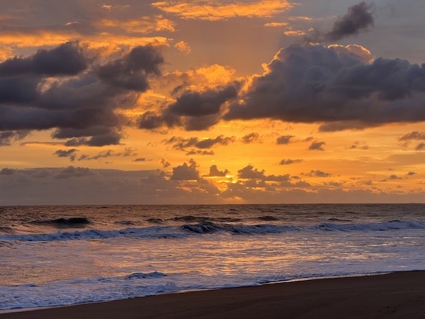
The sunrises were the best. I took the girls for their morning walk just after dawn.
I should mention that the signs made it pretty clear that they didn’t want dogs there. But there was no one around and my dogs are small and I pick up everything they leave. They weren’t romping through the dunes and mangroves, terrorizing wildlife. They were running on the beach, getting exercise and keeping me company. So no regrets.
There wouldn’t be so many goddamned No Dogs signs if other dog owners were more responsible about what they let their dogs do when loose.
The Ghost Boats
I think it’s my friend Kim who started referring to abandoned or neglected boats as “ghost boats.”
Let me tell you this: Florida is full of them. If they’re not washed ashore or sunk beyond recovery along the ICW, then they’re anchored in places like Peck Lake, waiting for owners who will probably never return. There were a bunch of them that Jason and I noted on our first visit to Peck Lake. When I returned the following week, I found that several of them had moved or changed.
How do I know they’re abandoned? First, no anchor light at night. Second, sometimes doors/windows are wide open. Nothing of any value remains on deck — fenders, boathooks, etc. Canvas is in tatters. Sailboats are either completely missing sails or have tattered sails flapping in the wind. It’s tragic and sad. Worse than airplanes left to die at airports.
There was Mar-a-Lago, which had a half-sunken dinghy. When I returned, the dinghy was gone. Sunk? There was also a stern anchor that I hadn’t noticed on our first visit.
There was 18 Bravo, which was parked near to “my spot” at the anchorage on our first visit. Apparently the high winds from the south had relocated it; I found it grounded on a sandbar on the far north side of the anchorage.
There was another boat, whose name I can’t remember, that wasn’t far from “my spot” on the first visit but was clear across the ICW in another cove when I returned. Had the wind pushed it there? Or somewhere else? Exactly how had it gotten there?
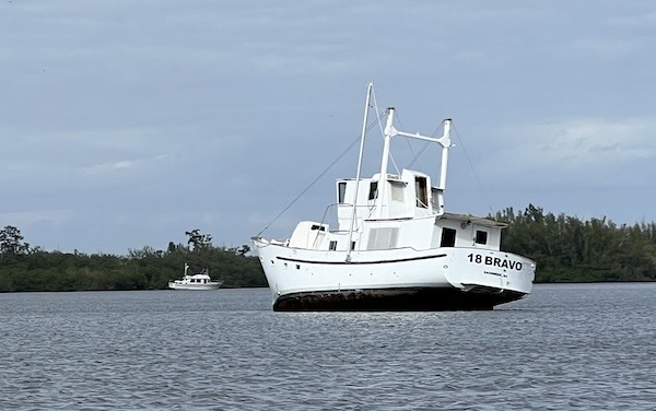
Here’s 18 Bravo with that other boat across the ICW in the background.
I could only imagine how rough it had been at Peck Lake during the worst of the weather. I was glad I hadn’t been there to see and experience it.
Lantana
Finally, I realized that I needed to move on. I’d made plans to meet Jason in Key West, where I had managed to get a crazy expensive one night reservation at a marina on New Year’s Eve.
But I’d also pretty much reached the limit of my electrical system without full sun every day. I have four house batteries and their main job at anchor is keeping the refrigerator running. I’d very optimistically filled the outside fridge and turned that on, too. My batteries were’t having any of that without enough sun on my solar panels to refresh them. On the third day of my stay, the inverter couldn’t power my coffee maker. I have my priorities: running the engine for a few hours would recharge those batteries so I could make coffee the following morning. Clearly, it was time to go.
(Of course, emptying that outside fridge would help. I’d do that later in the day.)
The weather wasn’t good but it wasn’t terrible. I pulled up the anchor, made my way out of the anchorage past all those other boats, and headed south.
It was slow going and that had nothing to do with me. There was one No Wake or Minimum Wake zone after another. Manatee areas. Boating safety areas. Any excuse to try to get cruisers to slow down. Not that it worked. Apparently these rules only apply to the suckers like me who obey them. Whatever.
And there were drawbridges, too:
- Hobe Sound Bridge, 21 foot clearance when closed.
- Jupiter Island Bridge, 25 foot clearance.
- Jupiter Bridge, 26 foot clearance.
- Indiantown Bridge, 35 foot clearance.
- Donald Ross Bridge, 35 foot clearance.
- PGA Boulevard Bridge, 24 foot clearance.
- Parker Bridge, 25 foot clearance.
- Blue Heron Bridge, 65 foot clearance. (Okay, so not a drawbridge.)
- Flagler Memorial Bridge, 21 foot clearance.
- Royal Park Bridge, 21 foot clearance
- Southern Boulevard Bridge, 25 foot clearance.
- Lake Avenue Bridge, 35 foot clearance.
- Lantana Bridge, 21 foot clearance.
I didn’t need any of these bridges to open — I need 15 feet of clearance but like a little more — but if I happened to approach one while it was opening for another boat, I had to stay clear of the bridge until it was fully opened. So that meant I couldn’t really cut in front of a waiting boat once the opening process had begun. This really slowed me down in places it shouldn’t have. But I wasn’t really in a hurry. The ICW was mostly narrow along the way and the cruising conditions were fine. I only had 34 nautical miles to cover.
It was after the Lantana bridge that I reached my anchorage for the night at the town of Lantana. It was a relatively small cove in what’s technically called Lake Worth. It offered shelter mostly from the north and west, but it also featured a boat ramp with a dinghy dock. That’s how I’d get my pups to shore. There was even a small park at the bridge approach so they could walk on grass.
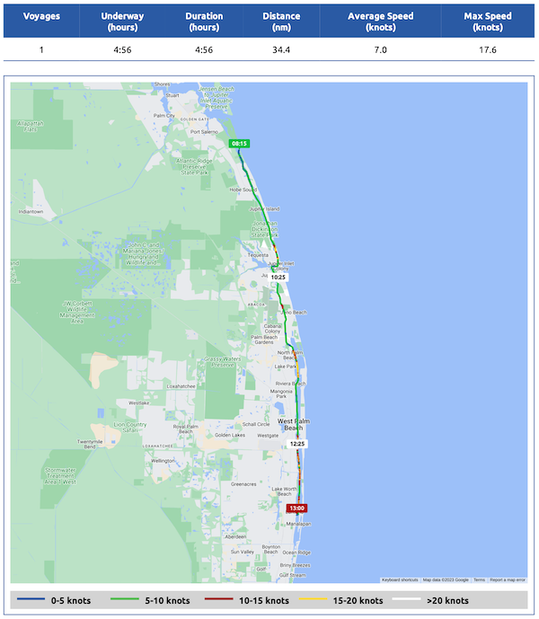
Here’s my Nebo log for December 22, 2023. Download a PDF log file with more info. Track Do It Now on Nebo.
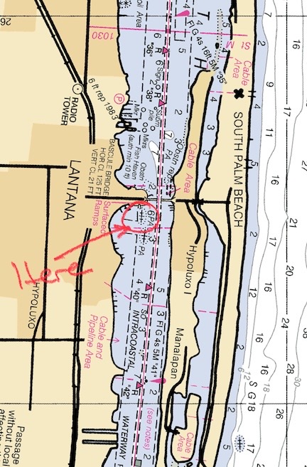
Here’s the Lantana Anchorage on a standard nautical chart.
I dropped anchor aligned with another trawler on his west side. I then realized that the spot I’d dropped my anchor might be restricted, so I hauled it back up, moved closer to the ICW channel, and dropped it again on the trawler’s east side. I was now the closest boat to the ICW and the boat ramp. There was plenty of room for other boats to get by, but that didn’t stop the locals from cruising as close to my boat as they could for the rest of the day and the following morning.
I took my pups to shore. The tide was pretty low so it was a bit of a climb to get off the dinghy and onto the fixed dock. Fortunately, on my other two trips to shore with them, it was near high tide and a lot easier. I took them for a walk in the park so they could do their business and then I took a walk up the road. There were three restaurants right there, including the Olde Key Lime restaurant I’d read about in anchorage reviews. I thought about taking my dogs back to the boat and then returning in the dinghy for lunch, but their dinghy dock was out of service and it would be damn near impossible for me to climb out of my dinghy onto their fixed dock without a ladder. So when I took my pups back the boat, I made lunch there.
The anchorage had at least a dozen boats in it and, as usual, quite a few of them appeared empty. Most were in good shape; maybe they’d been parked while the owner went elsewhere for the holidays? Christmas was only a few days away so anything was possible.
A while later, a familiar boat glided by: Pappa Whiskey, a Ranger Tug R-31 CB. I’d met the folks in Pappa Whiskey, Kathi Jo and Galen, way back at Green Turtle Bay in Kentucky the previous December. That’s where Galen, on hearing I had an issue with my windlass, came over with a tool, wrenched on it for about 10 seconds, and completely fixed it.
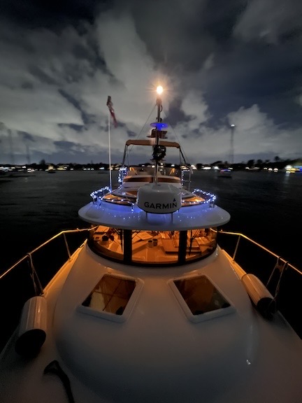
On a whim, I went up to the bow and took a wide-angle long exposure shot looking back at Do It Now that evening. Looks kind of cool!
They were close enough to call out to so I yelled over. They were also spending the night at the anchorage and they steered southwest through the area to find a place to drop anchor. Later they texted that they were going to the Olde Key Lime Restaurant for dinner. By that time, the sound of live music was blaring from the place and I had no desire to go over there. I wound up taking my pups to shore around sunset and getting takeout sushi and a bottle of sake for dinner. (It was good.)
I didn’t sleep well. The boat rocked incessantly and kept swinging in the wind on its anchor. The wind was out of the east so it could get some fetch up as it crossed the ICW to the anchorage. I haven’t got the hang of using my anchor snubber yet and if I don’t get it just right, it makes all kinds of noise. I wound up getting up in the middle of the night to adjust it. There’s nothing quite like walking out on the gunwales in your pajamas at 2 AM.
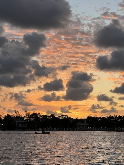
Sunrise from the Lantana anchorage did a lot to cheer me up.
In the morning, I was cranky from lack of sleep. I fed my pups, took them to shore to do their business, and walked up the road a little farther. I found a Walgreen where I could buy a quart of milk and then a nice bakery where I bought some pastries and a meat pie for later in the day. Then it was back to the boat, breakfast, and some time stowing loose items. I didn’t see the folks in Pappa Whiskey and figured they’d left; they had a 50+ mile trip to their next anchorage at Maule Lake in North Miami Beach. I just had 27 miles to get to my next anchorage, Sunrise Bay, in North Fort Lauderdale. But as I pulled out and into the ICW channel, I caught sight of them in the back of the pack at the anchorage. We texted back and forth a bit and I continued on my way.
Sunrise Bay
I headed south, letting my autopilot follow the Bob423 track while I tried to take in my surroundings. The areas I cruised through were mostly affluent. There were a lot of large homes with large boats. The natural areas were behind me now — it would be metropolitan, or at least suburban, for the next few days. And that’s what the ICW is all about — changes from one kind of area to another. Always changing, but with lots of repetition.
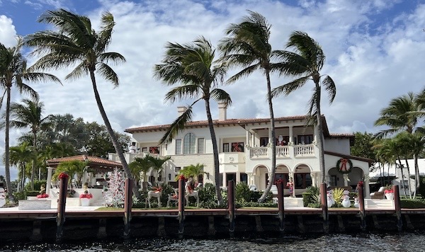
This house right on the ICW was really decked out for Christmas.
There were more bridges. Here’s a list:
- East Ocean Avenue (Boyton Beach) Bridge, 21 foot clearance.
- East Woolbright Road (SE 15th Street) Bridge, 25 foot clearance.
- George Bush Boulevard Bridge, 9 foot clearance.
- Atlantic Avenue (SR 806) Bridge, 12 foot clearance.
- Linton Boulevard Bridge, 30 foot clearance.
- Spanish River Boulevard Bridge, 25 foot clearance.
- Palmetto Park Bridge, 19 foot clearance.
- Camino Real Bridge, 9 foot clearance.
- Hillsboro Boulevard (SR 810) Bridge, 21 foot clearance.
- NE 14th Street Bridge, 15 foot clearance.
- Atlantic Boulevard (SR 814) Bridge, 15 foot clearance.
- Commercial Boulevard (SR 870) Bridge, 15 foot clearance.
- Oakland Park Boulevard Bridge, 22 foot clearance.
I had to wait for a few of these to open. Most of them are on schedules and open either on the hour and half hour, 15 after and before the hour, or once every 20 minutes. Boaters have know when a bridge is scheduled to open and call the bridgekeeper to request an opening at that time. Some bridgekeepers asked for the boat name, length, and air draft. If you make them open a bridge because it’s just your antennas or fishing gear that makes you too tall and you’re too lazy to put them down, they can fine you $11,000. At least that’s what it says on the bridges.
While I may have been able to get under the bridges with 15 feet of clearance, it was the sign boards at the bridges, which indicated minimum (not maximum) clearance at each bridge that helped me decide whether I wanted a bridge opened for me. The bridges with 15 feet of clearance had sign boards showing just 12 or 13 feet. I’m not going to risk my mast and bimini top on bad chart data. Besides, it usually wasn’t just me waiting for an opening. There were quite a few boats on the water that Saturday.
I stopped for fuel along the way. I didn’t need fuel, but I had learned that when cheap fuel is available, you should top off your tank. I was down 40+ gallons from a 145 gallon tank. I topped off for $3.94/gallon at Sands Harbor Resort, right on the ICW, I also took my pups for their midday walk so I wouldn’t have to do it when I arrived at the anchorage.
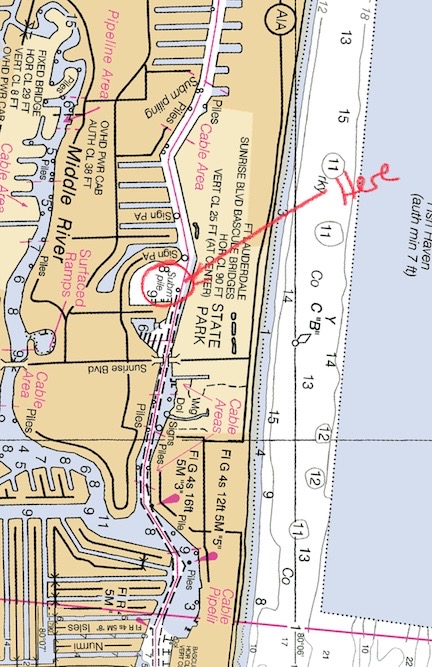
Sunrise Bay anchorage on a standard nautical chart.
It was afternoon by the time I reached Sunrise Bay, a cove right off the ICW in north Fort Lauderdale that is completely surrounded by homes with private docks. There was supposed to be a public dinghy dock across the ICW, but it was closed. If I were smarter, I would have gone to my second choice anchorage — I had some vague idea of another one farther south. But I was tired and done driving at Minimum Wake speed and dodging waiting traffic, including weekend-only day trippers, at bridges. I pulled into the anchorage, past the illegally placed No Overnight Anchorage buoys someone thought could scare boaters off, and dropped anchor among the nine other boats already there.
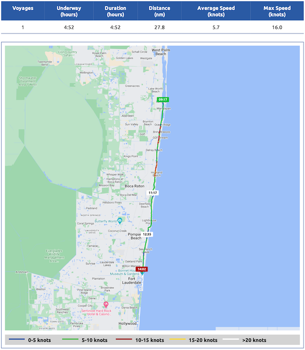
Here’s my Nebo log for December 23, 2023. Download a PDF log file with more info. Track Do It Now on Nebo.
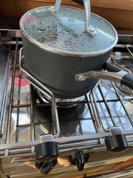
These two metal do-dad attach to a rail at the front of the stove to prevent a pot on the stove from sliding around. This is the first time I ever had to use them.
This anchorage turned out to be a huge mistake for me. Not only was it difficult to find and stealthily use a dinghy landing to take my girls for relief, but there was very little shelter from that pesky east wind and the wake from the ICW never seemed to end. It was the Saturday of a holiday weekend and everyone was out, basically ignoring the minimum wake rules of the channel in that area. My boat pitched and bobbed and swung on its anchor. It got so bad that I had to use my pot holders on the stove to keep my dinner from sliding around. At least I got the anchor snubber right and it was quiet.
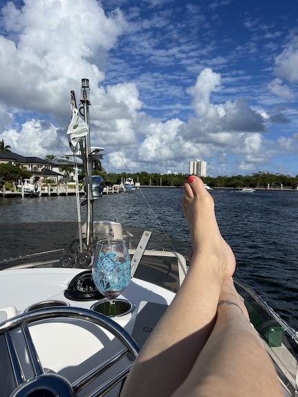
I didn’t exactly suffer the whole time I was there. It was nice to have a glass of wine up on the command bridge and soak up some sun in the afternoon.
And then there was the stereo noise. The trawler next to me played Pandora, with ads, through crappy speakers loud enough to be heard at every boat and beyond. First classic rock and then some twangy country rock. (Here’s a tip folks. Are you bothered that so many places are closing down for anchoring? Well, it’s partially because of assholes like this guy making noise that this is happening. When you’re camped out in someone’s backyard, at least be a little considerate.)
At some point, Pappa Whiskey drove by on their way to their anchorage. They estimated arrival at about 5:30 PM — right around sunset. I’d read up on that anchorage after they told me about it and hadn’t been impressed except for the possibility of calm water. But there was no reliable place to get my pups to shore and that’s always something I need to consider.
At Sunrise Bay, the wake situation only got worse after sunset. Now it was dark and these people could zip up and down the ICW anonymously. It wasn’t until after midnight that it finally settled down. At least the wake did. The wind driven waves did not.
I slept like crap and was miserable in the morning.
Maule Lake
Meanwhile, the folks in Pappa Whiskey had texted me to say what a great anchorage Maule Lake was and yes, there was access to shore. Not eager to get out into Biscayne Bay — my next destination — before the wind died down and eager to get some fresh fruits and veggies on board before I hit the Keys, I decided to give it a try.
So I pulled anchor before 10 AM and headed down the 11 or so miles to Maule Lake.
It was a pleasant cruise. It was early on Christmas Eve Day, and there was no one on the water. Despite the wind — one very strong gust blew one of my fenders off the bow — the water was mostly calm. Well, at least until I got near the inlet between the Atlantic Ocean and Fort Lauderdale’s ship terminals. After that it got kind of natural for a while with mostly mangroves on either side of the channel. Then it went back to metro/suburban. It was mostly Minimum Wake (of course) so I just plodded on through at 5 to 7 knots, depending on the current.
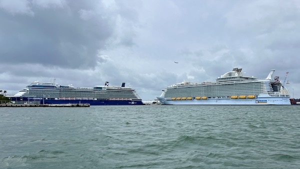
Two of the three cruise ships at Fort Lauderdale.
There weren’t nearly as many bridges and I didn’t need any to open for me:
- East Sunrise Boulevard (SR 838) Bridge, 25 foot clearance.
- East Las Olas Boulevard Bridge, 24 foot clearance.
- SE 17th Street (Brooks Memorial) Bridge, 55 foot clearance.
- Dania Beach Boulevard (SR A1A), Bridge, 22 foot clearance.
- Sheridan Street Bridge, 21 foot clearance.
- Hollywood Beach Boulevard (SR 820) Bridge, 25 foot clearance.
- Hallandale Beach Boulevard (SR858) Bridge, 26 foot clearance.
- William Lehman Causeway (SR 56) Bridge, 65 foot clearance.
Hollywood was a real downer after the obvious affluence of Fort Lauderdale. It may have been something once, but it seemed all rundown. Anchorages had sunken boats. A lot of the restaurants or other businesses along the ICW did not allow docking. It just seemed kind of unwelcoming. But maybe it was the weather: overcast and windy. And my mood, which was kind of glum.
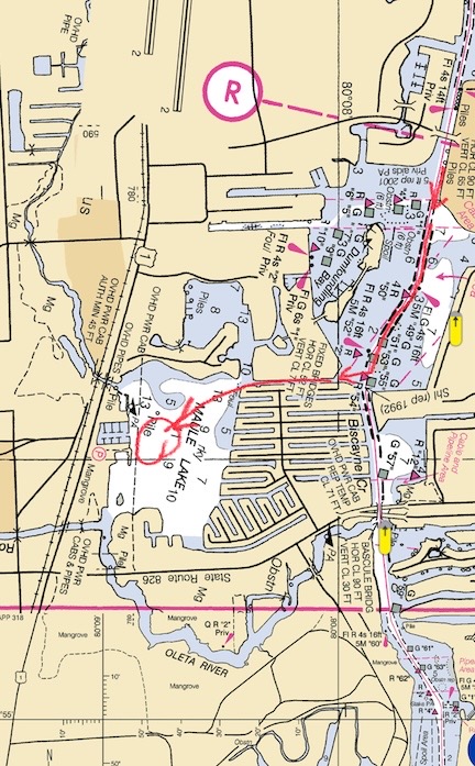
I had to follow a narrow channel through a neighborhood to get to Maule Lake.
I finally reached the turn off for Maule Lake. It required me to navigate down a narrow channel with homes and a handful of boats down one side of it. All of the boats were in the water; there were no lifts. I put my boat in idle forward speed and glided down to the lake.
The lake was way bigger than it looked on the map and a lot bigger than I expected given Pappa Whiskey‘s description. The wind was coming from the east, but the parking was on the west so there would be no shelter from the wind. I saw Pappa Whiskey and headed for it. There was a weird, homemade-looking buoy floating northwest of them; I dropped anchor between that and a sailboat north of me. As I played out rode to maximize scope in the strong wind, I found myself drifting too close to the sailboat. So I pulled up the anchor, repositioned closer to Pappa Whiskey and the mystery buoy, and dropped anchor again. I played out about 50 feet in less than 10 feet of water and shut down the engine. When I was sure I wasn’t moving, I played out another 20 feet of rode and put on my anchor snubber.
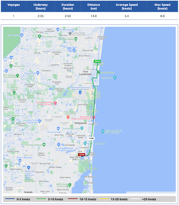
Here’s my Nebo log for December 24, 2023. Download a PDF log file with more info. Track Do It Now on Nebo.
Shore access would be either at the yacht club we’d parked near or at a West Marine a bit farther north. I opted for the yacht club; Pappa Whiskey had said they were friendly. I met two dockhands when I rode up. They made it clear that they were making a special exception to a rule for me to park my dinghy there. (I think they might have felt sorry for an older woman traveling with two dogs on Christmas Eve.) We tied up my dinghy and I followed their instructions to a nearby dog park. When I got back to the gate, they gave me the combination. I really appreciated all this because it was pretty clear later on that West Marine didn’t have a usable dinghy landing. The yacht club was my only option.
I took my girls back to the boat, had lunch, and ventured out again by myself with some shopping bags. It was a half mile walk to a place called Plum Market. (Think of a Whole Foods but smaller and more expensive.) I bought some fresh veggies, a pair of ribeye steaks, and a pork tenderloin. And some sushi go to.
I met Kathi Jo and Galen on my way back. They were just coming out of West Marine. We chatted briefly and then they continued away from the marina while I went back to the boat. They were still gone when I went to bed that night.
The wind didn’t let up all night, but it did shift. Now it was blowing out of the southeast.I didn’t sleep well because of the wave and anchor noise. When I got out of bed and checked my anchor alarm’s map, it reported that although the boat had swung, the anchor hadn’t dragged. But one look at Pappa Whiskey told another story. It was definitely closer to me — right in front of that mystery buoy, in fact. I later texted them and, after consulting something, they told me they’d dragged about 50 feet. As the morning progressed, I think they kept dragging. It was getting ever closer to me. Not enough to raise an alarm, but definitely something to pay attention to.
And that’s the trouble with anchorages: you don’t have to just worry about your anchor dragging. You have to worry about all the other boats’ anchors dragging, too.
It was Christmas morning and I was not happy with where I’d anchored. I wasn’t ready for Biscayne Bay yet, but I wasn’t going to deal with another 24 hours of being tossed around and getting wet every time I dinghied my pups to the yacht club for a pee break.
Jason had suggested another anchorage only a few miles away: Bakers Haulover Basin (or Oleta River State Park). I had actually looked at that anchorage during the planning process and decided that it wasn’t far enough from Sunrise Bay to make a stop. But that was before I was being relentlessly battered by wind and waves. And it was only 4 miles away. I texted the folks in Pappa Whiskey to let them know why I was leaving, pulled anchor, and left.
Bakers Haulover Basin
It was late Christmas morning and there weren’t many boats out on the ICW. The water was relatively calm despite the wind. I only had one bridge to pass — NE 163rd Street (SR 826) Bridge with a clearance of 30 feet — so that didn’t delay me. What did delay me was the continued Minimum Wake signs. So it took me about an hour to get to the turnoff for Bakers Haulover.
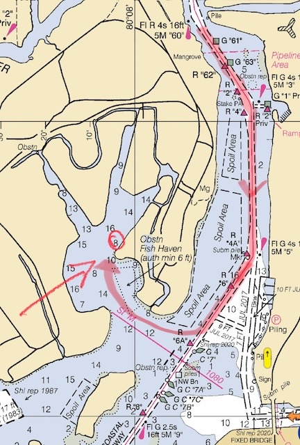
My approach and anchorage at Bakers Haulover Basin on a standard nautical chart. The infamous Haulover Inlet isn’t far from here.
I followed the entry instructions to the letter. It specified turning inbound (starboard since I was southbound) right before the Red 6A marker and hugging the shore. The water stayed plenty deep for me. The first thing I noticed on the way is in the huge yacht anchored at the entrance to the cove. The second thing I noticed was how many boats were already anchored in there. There had to be forty or fifty of them. But the anchorage was large with several “arms” that had deep enough water for me. In the end, I wound up parking near the east shore just inside the northeast arm. I was right out of the wind, which had shifted to be from the southeast.
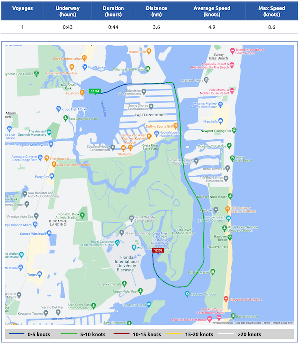
Here’s my Nebo log for December 25, 2023. Download a PDF log file with more info. Track Do It Now on Nebo.
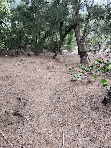
I found a great spot to let my girls run and do their business.
My anchor went straight down and my boat didn’t move an inch. I still let out 30 feet in the 10 feet of water I was in. There was some noise in the park that was annoying at first but then switched to live music with an amazing fiddler and a vocalist singing in Spanish. Lots of rental kayaks and stand-up paddleboards made their way awkwardly between the boats in the calm water. I found a gravel beach not far from where I was anchored and took my pups over. It was remote and shaded with long-needled pine trees. The ground was covered with them. My pups finally had a good chance to run around a little.
A day tripper in a big boat came in and dropped his anchor near my boat and then backed up to set the anchor, almost hitting the boat behind him. They tried again a little closer to me but not too close. I knew they were day trippers because there were too many of them on the boat for the amount of sleeping space it probably had. And they didn’t know how to use their anchor.
It wasn’t long before I began to realize that of the many boats all around me, very few were occupied. Most of them weren’t derelict, though. They seemed to be parked there in a safe anchorage while their owners went elsewhere for the holiday. Of course, there were a few derelict boats, too. After all, this was Florida.
It started to drizzle and, as if on cue, all the kayakers and paddleboarders headed back. The day trippers pulled up their anchor and glided away. The live music stopped and the place got quiet. When the rain let up, I fed my pups and took them to shore for their evening pee break. Then I went back and made my little Christmas dinner: grilled pork tenderloin, grilled sweet potato slices, and brussels sprouts sautéed with onions and bacon. I ate it out on the back deck with a glass of wine and some nice music on the stereo.
There’s really nothing like a nice, peaceful Christmas.
Seven Night Report
Bakers Haulover Basin was my last of seven consecutive nights at anchor. Do It Now had done well — my only power issue had been on the third cloudy day in a row at Peck Lake, and I suspect it was because I’d asked them to keep two refrigerators running. The batteries sufficiently recharged themselves every day I cruised, with a boost from the solar panels on bright or sunny days. I hadn’t run out of water. I hadn’t run out of food, either, although that Plum Market trip had been welcome. My holding tank didn’t even fill halfway.
Having my new dinghy davit made it very easy to anchor out. No more messing around getting the dinghy’s motor on and off. It stays on. I can launch in it 5 minutes and retrieve it in about 8 minutes. Planning ahead usually made finding a place to go ashore easy; I do need to work on that a bit more.
Keep me caffeinated so I write more!
While marinas usually have their pros — unlimited water available, nice bathrooms and showers, laundry facilities, shopping and dining within walking distance, and docktails with other cruisers — anchorages can have pros, too. Quiet, privacy, and a nice beach to walk on are all important to me and my pups.
And you can’t beat the price.
Very nice write up. Quite detailed. Appreciate the time you took to do this.
Seems like the SE coast of Florida, while generally good weather, might not be my kind of place. To many crazy, inconsiderate and unruly folks for me.
I am just now re-starting to look for a possible loop boat. I went through the exercise about 2 years ago. Long story, but with a surgery and good pathologist report behind me, I am going to try again. I’ll be solo with my chocolate lab, Lacy. Your posts strike a chord with me.
Thanks very much. It took a lot longer than I expected. I think I should have written them up separately. I really need to learn how to cut unnecessary detail without losing the important stuff.
Might I suggest a Ranger Tug for a loop boat? I’m actually getting ready to write a blog post about what makes it such an excellent loop boat, especially for single-handers. There are some used ones out there and a handful of dealerships around the country.