October 9, 2023: We visit historic St Clements Island before weaving our way through crab traps in shallow water in search of shark teeth.
We did our morning routines before getting together on my boat for coffee, oatmeal, and trip planning. Jason was the tour guide so I let him tell me his plan and just went with it. (I cannot express how refreshing it is to be with someone who doesn’t need me to make every suggestion or decision.) The plan was to leave Leonardtown Wharf, backtrack down Breton Bay, and make a stop at the ferry dock on St Clements Island. After walking around the island for a while, we’d cast off and continue south across the Potomac to an anchorage between Shark Tooth Island and the Virginia coast.

A view from the flybridge on Seki-A looking down at Do It Now at Leonardtown Wharf. One of these days, I’ll have to take a picture where my boat looks bigger than Jason’s.
The Cruise to St Clements Island
Conditions in Breton Bay were calm as we cast off from the dock and headed southwest toward the Potomac. Unfortunately, those conditions didn’t last. As soon as we got out of the bay, the wind was blowing and waves were building. Still, it wasn’t as bad as it had been the last time we were out there and our destination was relatively close: a small island just off Coltons Point. There’s a ferry from a museum there that goes to the island on weekends (and maybe more often during the summer). It was a Monday, so the dock where the ferry usually lands was available for docking by boats like ours. The trick would be to land there in the mildly rough conditions we faced.
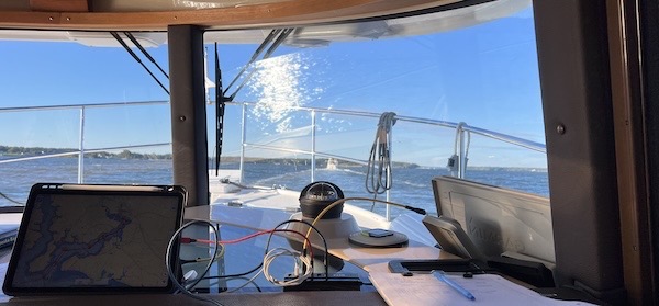
My view as I followed Jason out of Breton Bay that Monday morning.
Jason went first in Seki-A. The wind was blowing from the west, making it easier to dock on the west side of the long dock. For a moment, Jason hesitated, saying over the radio that he needed to move his fenders to the port side. I suggested making a 180° turn before docking, which would put his already prepared starboard side against the dock. So that’s what he did. The wind and waves helped push him against the dock.
It was a fixed dock with thick vertical wooden pilings. This is pretty common at marinas, but unless those pilings have padding on them, they rub hard against the rubrails on a boat. If you have large round ball fenders, they can usually fit between the dock and the boat, keeping the boat off the pilings. Jason had these on Seki-A. I didn’t have them on Do It Now.
Although there might have been enough space right behind Jason for me to park, it looked tight. The ferry docking area, which jutted out from the main pier, would form a hazard behind me. So I decided to just turn around and land at the ferry docking area, which would not be used that day anyway. It was easy enough to land there, but I wasn’t happy with the way my boat kept getting pushed by waves into those pilings. I tried arranging fenders to fix the problem, but they didn’t stay put. In the end, I just gave up and hoped for the best.
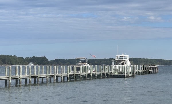
A look back at our boats packed along the ferry dock at St Clements Island. The water doesn’t look very rough here, but the wind and waves were definitely banging our boats against the pilings.
At St Clements Island
With our boats secure, we walked down the pier with my pups and stepped onto the island. Other than the remains of another severely damaged dock beside the one we’d landed on, the place was extremely well maintained, with mowed grass, wide pathways, a canopy of trees, and picnic tables. There were no other people on the island at all, but we did see some small deer that ran off when they saw us.
I let my pups have a good run up and down the grassy walkways as we strolled south down the length of the island. There was a covered picnic area there that might be good for groups. There was also a giant white Christian cross, a lighthouse with a residence, and a bell with plenty of interpretive signage to explain what you were looking at.
Although you can learn a lot more about this historic place on Wikipedia, here’s the short version: St Clements Island was the landing spot, in 1634, of Maryland’s first colonists from England. 150 settlers lived there as they negotiated with the local Native Americans for land for a permanent settlement. They named the island in honor of Pope Clement I, patron saint of mariners. The island is roughly 62 acres in size and later became home of a lighthouse, which was destroyed and then rebuilt as a replica. There’s a lot more to know about it, but I’ll let you read what Wikipedia and the Maryland Department of Natural Resources website have to say.
We walked around and took photos. I rang the bell. We walked along the other dock, which was in decent shape but likely built for smaller boats. It was weird being the only ones there but also very pleasant. I think that the older I get, the less I want to be around other people and their rambunctious children.
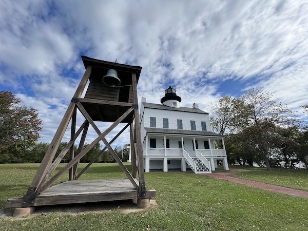
Here’s a weird wide-angle view of the bell and lighthouse building at St Clements Island.
We walked back on a different path that took us past some maintenance buildings on a gravel road. Then we went back to the boats. I cast off first, with Jason tossing me my lines, and he cast off after me. I waited until he was clear of the dock before leading the way to our next stop, the anchorage behind Shark Tooth Island.
The Cruise to Shark Tooth Island Anchorage
To get to our anchorage, we had to cross the Potomac River which was still windy and rough. It wasn’t bad at first — we had to go southeast around the east side of St Clements Island, which provided some level of shelter from the wind and waves. But once past there our route was pretty much due south. That put the waves at our beam.
I have some experience with this and none of it is good. Even 1-foot waves — which is probably what we had here — on the beam rock my boat uncomfortably and send anything that isn’t secure flying all over the boat. While I realize that I should have secured all loose items, it is surprisingly difficult to do, especially when I’m in the middle of unpacking the multitude of boxes I shipped ahead to be on the boat with me. (I wonder daily what the hell I was thinking.) But worse than that is the real possibility of my dogs getting sick. The last time we were in very rough water — which I hope is the very last time — they both puked twice on the seat next to me and even I came close to puking. As we entered what was about a 3-mile stretch of open water with wind and waves on our starboard side, all I could think about was stopping the rocking so I wouldn’t be cleaning up dog puke later.
The answer, of course, was to head more into the wind. So I turned about 45° to the right, putting those waves on our starboard bow. The change in the ride was immediate. Yes, we still bumped up and down on the waves, but at least we weren’t rocking. My pups calmed down. I told Jason what I was doing and soon he was tacking into the wind behind me. You can see exactly where I changed course in the Nebo map below.
After a while, it was time to tack back. So I turned again, this time to port. The waves weren’t as bad, perhaps because we were closer to land on the west side of the river. So often waves are generated by fetch — wind over long stretches of open water. You can often get away from waves by staying closer to shore in the direction the wind is coming from. My initial tacking had taken us close enough.
By this point, I was crossing Nomini Bay. I knew I was headed for the south end of the island, but I couldn’t really see the island. The trouble was, the island was very close to sea level — I don’t think there was a hill or tree more than 20 feet on the whole thing. So I had to trust my chartplotter to put me in position. And as soon as I got into shallower water, I had my next problem: crab traps. They were everywhere.
I’m very used to dodging crab traps, which have been in the water since I got on the Gulf ICW nearly a year ago. But dodging them while venturing into ever more shallow water is a whole different game. And although crab traps are usually set in easy to follow (and avoid) rows, these seemed to be plopped down randomly. So now I had three challenges ahead of me:
- Stay on course to my destination.
- Avoid the crab traps.
- Avoid the shallow water.
It got to the point where it was just too much for me. I made a sharp turn to port, heading toward a channel there. I knew the channel would be free of crab traps. Once I got there, I could relax for a moment, consult with Jason, and come up with a new plan.
I was in the channel and had turned around when I realized that Jason was going for it. He’d approached from a slightly different angle and was apparently not as challenged as I’d been. So I headed back down the channel toward the minefield of crab traps in Currioman Bay. And suddenly they were all lined up as usual. Approaching from a different direction was all I needed to do to see them lined up and easier to avoid.
Eventually, we were past most of the crab traps and coming up on the Active Captain anchorage coordinates in Currioman Bay. I slowed way down as Jason dropped his anchor. When he gave me the word, I steered Do It Now in beside Seki-A. I handed him a midship line and we tied our two boats together. We had arrived.

Here’s my Nebo log for October 9, 2023. Download a PDF log file with more information here. Track Do It Now on Nebo.
A Trip to Shark Tooth Island
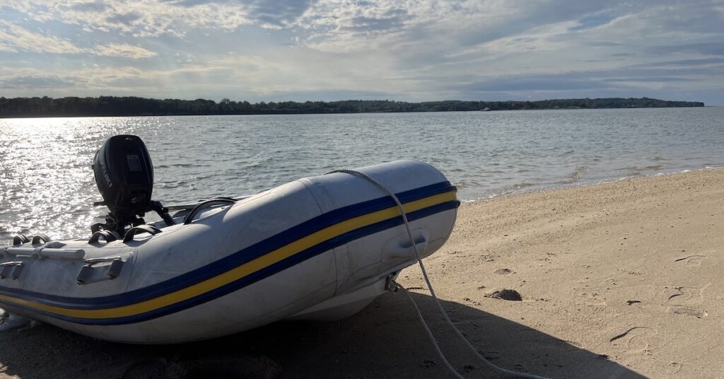
We had lunch. It was still rough in what I thought would be a sheltered bay and our boats rocked. But that didn’t stop us from launching my dinghy, loading up my pups, and heading to Shark Tooth Island.
The tide was pretty high but going out. We landed on the island, not far from the remains of a building. We walked along the narrow beach there and Jason really impressed me by finding on shark tooth after another.
Soon we found our way blocked by fallen trees that would have us walking in the water or through tall vegetation on land. We went back to the dinghy and repositioned farther south on the island, right where it splits at high tide. There was now plenty of beach and we could walk from one half of the island to the other.
My pups really loved running on the beach. I watched them carefully. When Rosie
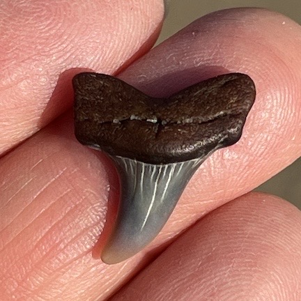
I found this shark tooth on the beach about four inches behind a dog poop I’d bent to pick up.
stopped to take a poop, I came with a baggie to pick it up. That’s when I found my first shark tooth, and it was a beauty!
We must have spent about an hour walking along the beach looking for shark teeth and interesting shells and rocks. While we walked, three people arrived in a pair of jetskis and parked near the dinghy. Later, when we went back to the dinghy, we passed them. They were beachcombing, too, but with sticks that had little baskets on the bottom so they didn’t have to bend over so much. (I think I’d rather bend for the exercise.)
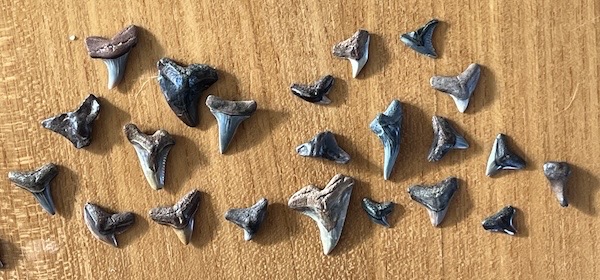
Our shark tooth collection. Jason found most of these.
Back at the boat, the wind and water had calmed considerably. We had dinner together on Jason’s boat and were treated to an excellent sunset over calm water.

We were treated to a great clear night sunset. That bigger dot is the moon with Jupiter (I think) in conjuction nearby.
