December 9, 2022: Even more fog and, finally, a change in current.
(continued from Clifton to Pickwick Dam, TN)
It was wet when I woke up. Not terribly cold, but very wet.
I got a chance to see my surroundings as it got lighter out. After coffee and breakfast, I took my pups for their second walk, went in to pay for our slip, and then arranged to get fuel.
While I was moving Do It Now over to the fuel dock, the only other boat that had shown signs of life that morning, a sailboat named Resolute, motored quietly out of the marina, carrying its mast down the length of the boat. Another Looper. We’d chat with them on the radio and in Nebo and eventually pass them.
I only took 26 gallons of fuel, which kind of surprised me. I think I was still suffering from a fear of running low on fuel and was getting fuel more often than I needed to. That’s okay. In aviation, we have a saying: the only time you have too much fuel on board is when you’re on fire.
After I paid for the fuel, we headed out of the marina.
More Fog
Inside the marina, which was bordered on all sides by low hills, I hadn’t noticed any fog. But outside the marina, back in Pickwick Lake, the fog was thick. Very thick. Clearly I was destined to not see any of this lake.
By this time, I had become somewhat of a pro at navigating the boat in fog. So I set a relatively slow speed and we went on our way. We only had a short distance to travel on the lake until we’d make a right turn onto the entrance of the Tennessee-Tombigbee Waterway — or Tenn-Tom Waterway, as most folks refer to it. I moseyed along at under 7 knots, navigating with my chart plotter, trying to (and sometimes succeeding in) finding charted markers, and tooting my horn every 2 minutes.

Well, we managed to spot this marker, but not much else beyond it. We were only a few hundred yards from shore here.
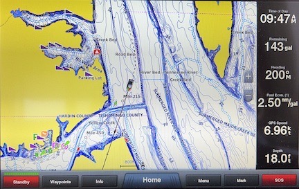
There was plenty of detail in the chartplotter’s view of Pickwick Lake. In this shot, I’m cutting the corner to make that right hand turn into the Tenn-Tom Waterway’s entrance.
What’s weird about traveling in the fog is that sometimes you feel as if you’re turning or moving in a certain direction and you’re not. You really have to trust the chart plotter. It puts your position on a nautical chart and tells you which way you’re going. It’ll tell you you’re going straight even if you feel as if you’re turning. The best way to deal with this weird disorientation is to set the auto pilot’s heading hold and adjust it as necessary to keep your position where it needs to be on the chart. Don’t try to hand steer — you’ll be all over the place.
After a while, the fog started to lift, revealing the homes built right up to the shore on this very large (but invisible to us) lake. The water was dead calm — as you’d expect it to be in the fog — and some of the homes appeared mirrored in the lake. It was peaceful.
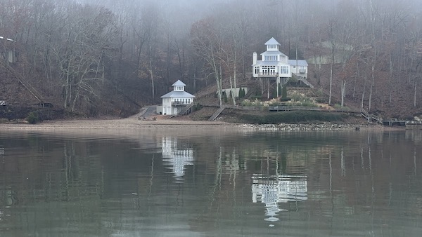
I really liked this home and its smaller sibling on the shore.
Then we made the turn into the Tenn-Tom Waterway and the fog pretty much cleared out. We passed the marina my friends had warned me not to stay at because the water had been turned off: Grand Harbor Marina. There were just a few boats on the water that morning. I steered us down the channel and to the end of that arm of Pickwick Lake where the main canal of the Tenn-Tom Waterway began.
Although we couldn’t really feel it then, we were now going with the current instead of against it for the first time since we’d turned into the Ohio River the week before. Little did we know how much of a boost that would give us in just a few days.
The Plan
Alyse had been under the impression that she could get off the boat at just about any marina and get ground transportation to a major airport where she could fly to Seattle or Los Angeles. By this point, she’d pretty much realized that was not the case. We had to follow the rivers — we had no choice — and the rivers went by or through a lot of small towns where we’d be lucky to find a decent grocery store, let alone transportation to a major airport.
I never realized this is what she’d expected or I would have told her it was unrealistic. I thought she understood that she’d have to get a one-way car rental at a big town like Columbus and drive to the airport of her choice: Memphis, Nashville, or Knoxville. Or a longer drive to a bigger city. But she told me that her eyes were bad and she didn’t want to drive. This was news to me.
The only alternative was to stay on board until we got to a city with a big enough airport for her to catch a flight. The first city on our route that met that criteria was Mobile and we were still at least 10 days away. When did I think I could get her there? The question kept coming up. By that time, I did the math and gave her a date: December 19. She’d be safe booking a flight for any day after that.
So she booked a flight from Mobile to a connecting city and then on to Los Angeles on December 20.
The clock was now ticking.
I realize now that this was a mistake. By having a deadline, we rushed through a lot of places where we could/should have spent more time. We also made at least one potentially foolhardy go/no go decision. But she was already bothered that she’d had to cancel a doctor’s appointment for December 15. Her general unhappiness about the trip apparently not meeting any of her expectations was starting to rub off on me.
In the 20/20 vision of hindsight, I know what I should have done: I should have had her book a flight from Memphis, rented a car in Columbus, and driven her to Memphis Airport. Yeah, it would have taken all day to make the round trip drive, but at least we’d both be happier sooner.
But that day, I wasn’t thinking of that. Instead, I planned on getting us all the way to Midway Marina in Fulton, MS — a distance of nearly 60 nautical miles. (Midway, by the way, gets its name from being midway down the Tenn-Tom Waterway.) I had a deadline now and I couldn’t miss it.
The Canal
A canal linked Pickwick Lake and the Tennessee River that fed it with the Tombigbee River. It was a typical canal, dug out of the ground with a uniform depth and width. The land it had been dug from formed hillsides or levees on either side. It was straight in most places but also had a few gentle curves to change the general direction. It wound its way on a mostly southerly route for 25 statute miles until it reached the northern end of the first lake, Bay Springs Lake.

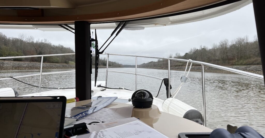
Here’s the view from my seat as we headed down the canal. What a gray day.
It was pretty dull going. It was a mostly gray day, but at least it was neither foggy, rainy, nor very cold. There was no view on either side because we were basically looking out at the sides of the canal, with bare trees on top. I don’t recall passing any communities. We went under four bridges, all of which were fixed.
Meanwhile, I’d struck up a conversation on Nebo with the couple in Resolute. They warned me about a dredging operation that I’d have to call and talk to. They didn’t and they almost ran over the dredging pipes and the boss of the operation got really pissed off. So I did some research and found a notice of it on the Coast Guard’s publications. I also saw the name of the dredging boat on my AIS.
I called when we were about a mile away and was told to call again when we were closer. When I called a few minutes later, he seemed surprised. Maybe he thought I was going slower than I was? He told me I needed to be at no wake speed and pass on the down bound right side after his crew moved the pipes. Some small boats were already in action, moving pipes on floats out of our path. I crept through at idle forward speed, coming very close to the main dredging barge. Then we were passed it all and he was thanking us and I was picking up speed.
The Lakes
The canal opened up into a lake, complete with dead trees coming out of the water outside the channel. We could now see Resolute ahead of us. It was 1:50 PM when we passed him; I sent him the photo I took.
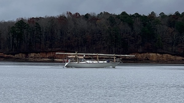
Here’s Resolute, as we passed it in Bay Springs Lake. They were overnighting at an anchorage at the south end of the lake.
At the bottom of Bay Springs Lake, we locked down at Jamie L. Whitten Lock. There wasn’t much of a wait to get in. It was nice to lock down instead of up.
Six statute miles later, we’d gone through some more canal and another smaller lake. There was no wait at the Montgomery Lock.

My view out the window at Montgomery Lock, just as the gates were opening.
Another eight statute miles later, we’d gone through more canal and another small lake. We locked through at John Rankin Lock quickly. It was a good thing. It was already 4:30 and sunset wasn’t far off.
I hauled ass those last four miles. I think I might have had it up to 3000 RPM. The sun set behind thick gray clouds and it started getting dark quickly. Then I saw the marina off on the port side. I almost cut the corner to get to it, but then I saw the tall dead trees rising out of the water along my intended path. I stuck to the channel and followed the markers, which I could barely see, into the marina. A dockhand directed me to a spot between two boats on a long dock.
I parked the boat, really glad to be done for the day.
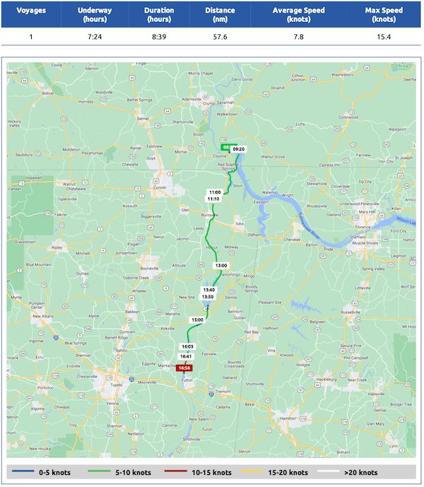
Here’s the Nebo log for December 9, 2022. Download a PDF log file with more info. Track Do It Now on Nebo.
At Midway Marina
I took my pups for their first walk and handled a mission that had been assigned to me by Connie on La Princepessa. She and Michael had planned their stop at Midway and had been there for a few days. Connie had made an online purchase and had it shipped there. Unfortunately, the package was delayed and they had to leave before it arrived. Knowing that I was coming through and assuming we’d meet up in Steinhatchee, FL (where she lived), she asked me to pick it up for her. So, when I went into the office to settle up my bill for docking, I picked up two small packages for her. I’d carry them with me for the next month or so.
Later, Alyse and I went up to the marina’s restaurant for dinner. Kim on Pony and Connie had both raved about the place. I was eager to eat out and I know Alyse was, too.
They sat us on the outside patio, at our request. It was completely closed in with vinyl sheet windows, so it wasn’t the least bit cold. It looked out over the marina.
I don’t remember what I had, but I know that it was good. Alyse enjoyed hers, too. The waitress was good, too, and that really means something these days. I think I took dessert to go — key lime pie — and ate it back at the boat. It was so-so. It’s hard to get a good key lime pie outside southern Florida.
Another walk with my pups and then we all turned in. I was exhausted and slept well.
(continued in Fulton (Midway) to Columbus, MS)
