October 25-27, 2022: We spend three travel days with two marina-less nights getting back to civilization.
(continued from At Peoria, IL)
We left the free city dock at Peoria early in the morning with Nine Lives, leaving the sailboat Yucca behind. Kenny in Nine Lives had called ahead to the Peoria Lock, five miles downriver, to assure that we could be locked through quickly.
I should mention here that calling ahead is something recommended for most locks, especially if you’re tucked in at a cosy marina or anchorage just upriver from the next one. The deal is this: if a tow needs to lock through, the tow gets priority. So even if you beat a tow to the lock by 15 or 30 minutes, if the lockmaster knows he’s coming — and he does know — you’ll have to wait for that tow to go through. By calling ahead and asking about the chance of being able to lock through quickly, if there’s going to be a wait, you can wait comfortably where you are instead of circling around the outside of the lock for what could be hours.
Of course, if you’re locking down and the tow is locking up, a nice lockmaster might let you lock down as he dumps the water from the chamber to let the tow in. There are all kinds of exceptions to all kinds of “rules.” You’re basically at the mercy of the lockmaster and the traffic he has to handle. It seems that a lockmaster is more likely to make an exception to a rule if you’re one of multiple pleasure boats rather than one traveling solo. And the absolutely worst thing you can do it piss off a lockmaster by being rude or demanding. (In a way, it’s like dealing with air traffic controllers at an airport; they can let you take off/land or make you wait.)
Cruising for Miles
After locking through, we continued downriver at a faster pace than Nine Lives. Kenny and Rhonda are never in a hurry and and smart/experienced enough to cruise at a somewhat fuel efficient pace. It would take me a while to learn that lesson. It wasn’t as if we were moving fast, but we were moving faster than they were. So little by little we left them behind.
The river had been cursed by low water caused by a drought and it was beginning to take its toll on river traffic. Barges weren’t able to fill as much as usual — the more cargo they take on, the lower they sit in the water. The news had been full of stories about grounded barges on the Mississippi River much farther south. It hadn’t gotten that bad on the Illinois River (yet), but we overheard at least one tow captain talking to a lockmaster about it. Eight feet, he said. They weren’t letting the barges draft more than 8 feet.
Of course, this didn’t affect me — or at least it shouldn’t. My boat’s draft was just 2 1/2 feet — 30 inches! — and I could go into very shallow water without getting stuck. But what it did affect was the ability of marinas to stay open. We’d gotten a glimpse of that at Henry Harbor — they’d basically closed the main marina because shallow water made it difficult for boats to get in through the entrance.
The same thing happened at Tall Timbers Marina in Havana, IL, which is where I’d originally planned to stop. Way back in Ottawa, I’d been told that Tall Timbers was probably going to be closed. I decided to give them a call as we motored downriver. The man who answered said that with my shallow draft, I might be able to get in and I was welcome to try. He wouldn’t be there, though. That sounded a little too iffy for me. I didn’t like the thought of getting stuck at the entrance to a marina, especially with no one around to lend a hand.
In the meantime, Kim in Pony, which had left Ottawa the day before we did, raved about an anchorage much farther south, just past Beardstown, IL. It was called Bar Island. That’s where La Principessa, which had left Peoria the afternoon before, was aiming for. It would be a long ride and I made note of a few anchorages that looked good before that. But the way I saw it was that the farther we got that day, the less likely it was that we’d need two nights at anchor — and I found that very appealing.
So we motored on. I only shot two photos, mostly because the day was gray and I didn’t find anything that appealing. (Even then, I don’t know what I found appealing about that second photo, which looked like a dock at a campground and is so dull I won’t bother sharing it. We kept our speed below 10 knots most of the day; I think the only time we sped up was to pass a tow. We passed Tall Timbers and, one by one, we passed the other potential anchorages along the way.
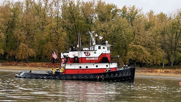
I’m certain that I shot this photo because I thought this tugboat was cute. Red is my color.
Connie in La Principessa texted sporadically throughout the day. By late afternoon, they had arrived at Bar Island and anchored. She raved about it, echoing Kim’s sentiments. I thought about how nice it would be to do my first anchorage — I did mention this would be my first time at anchor, right? — near someone we knew in case we needed some sort of assistance. And this certainly seemed like a good one. So we motored on, now determined to get there before sunset.

Here’s my Nebo log for October 25, 2022. Download a PDF log file with more info. Track Do It Now on Nebo.
Bar Island Anchorage
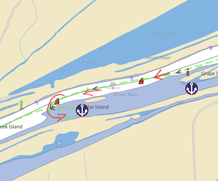
Here’s the setup at Bar Island Anchorage. My actual track from that day and the next is the green dashed line. I marked my arrival path with red arrows.
I had notes from Jeremy’s briefing at Ottawa about this. They were actually notes taken by Captain Paul in the map book he eventually mailed me. It was specific about how to enter the anchorage. I had to go past the red marker past the island and then come in from downriver. I followed his instructions; you can see the green dashed line in the Aqua Map image here.
La Principessa was anchored about mid-island, past the anchor icon in the image. I didn’t want to get too close because I knew there was a chance we could swing at anchor. So I stopped right about where the anchor icon is and asked Janet to drop the anchor.
This was Janet’s first time at the windlass and it was only my third time dropping the anchor. (My previous two times had been in training and they hadn’t gone as well as I’d like. Dropping the anchor wasn’t the problem; retrieving it was, as you’ll see in a few moments.) The windlass is easy to operate with a pair of foot pedals — one for down and one for up. I tried to bring the boat to a stop in the middle of the channel while she did her thing. I was expecting the current from upstream to push us downstream a little, but what happened is that wind from across the river pushed us toward shore. So when the anchor set, it set more toward the south side of the channel. As instructed, she let out all of the chain — I have about 50 feet — and a bunch of the rode. I was shooting for a 5:1 ratio — five feet of anchor rode for every 1 foot of depth.
The anchor held but the boat swung to the south, toward land, instead of west, downriver. It was the wind, which was blowing pretty hard. I set an anchor alarm — I use an app called Anchor Pro (highly recommended) that tells me if the boat moves more than an amount I specify.

Connie shot this photo from La Principessa not long after we arrived and dropped anchor.
By this time, my pups were excited. We’d stopped for the day. It was time for a walk. They were very disappointed when I took out their “pee place” — a plastic tray with a piece of astroturf-like material in it. I told them to “go pee” more times than I could count and was met with blank, anxious stares. They would not use the designated spot that day. But, to their credit, they didn’t soil the rugs or floor inside the boat, either.
And yes, I do have a dinghy. But I hadn’t actually used it yet. And with no easy place to land it on either the land off our stern or the island, I wasn’t going to try.
We had dinner and relaxed for a while, then went to bed.
I didn’t sleep well. I kept imagining the boat drifting backwards onto the strip of land behind us. I was convinced that the boat’s prop and rudder would be stuck on land, making it impossible for us to leave. But each time I got up to take a look, we were right where we should be, about 50 feet from the bank. Closer than I wanted to be, but not too close.

Making breakfast steamed up the windows, but maybe there was some fog out there, too?
The next morning, after trying with limited success to get the dogs to pee or poop on their pee place — Lily peed, Rosie would not — we had breakfast and prepared to leave. And that’s when the trouble started.
You see, we couldn’t get the windlass to smoothly bring up the rode and chain. It kept getting jammed. The only way to make it work continuously was to open the anchor locker, reach underneath, and pull the rode through as the windlass operated. This was the exact problem I’d had during training and I didn’t know how to resolve it. Back then, we thought it was because the rode was twisted and I figured we’d fixed the twisted rode when we laid it out in Chicago to mark the length. But we obviously hadn’t.
So as La Principessa motored away from us, we struggled with the windlass.

I shot this photo of La Principessa just before we started dealing with the windlass. If you look closely, you can see Connie in the doorway taking a photo of us.
The main problem with all of this is that with the wind still blowing us toward shore, as soon as the anchor lifted, the boat would drift backwards until it hit something that would stop it. It was vital that someone be at the controls to prevent that from happening. Somehow, we made it work. We got the anchor up and powered away from the shore. I drove over some shallow water on the way out and seem to recall having to go out and flip the anchor around to fully stow it. But we were on our way.
I had to do something about the windlass. I just didn’t know what.
More Miles
It was a beautiful day for cruising. We continued along the Illinois River, catching up with La Principessa and locking through with them at La Grange Lock and Dam. Because I like to cruise at a slightly faster pace than Michael in La Principessa, we passed them and, after 5 or 10 miles, they were out of sight behind us. While it was nice to travel with others, I didn’t feel a need to be close together all day. I wanted to give them room to move at their own pace.

Here’s Janet at the helm, making a note in her logbook while Lily and Rosie snooze on the seat beside her. I learned early on that putting the dogs up on the high seat kept them in sight but out of the way while we were under way.
Like other days on the trip, Janet took the helm for a while. This is one of the benefits of having a competent crew member on board. I don’t mind driving the boat — there really isn’t anything to it unless conditions are weird or we have to pass a tow — but it’s nice to be able to grab a bite to eat or take photos or use the head without having to stop the boat.
By this time, the scenery had become somewhat monotonous: a mostly narrow river winding through wooded areas. We didn’t see any wildlife other than birds — lots of water birds but also some bald eagles — the same thing we’d been seeing most days. What made the day pleasant was that conditions were good for cruising. It wasn’t raining and even the wind seemed to have let up.
Every once in a while, we’d pass an area where barges were loaded or parked and sometimes work was in progress. It was interesting to watch and I snapped a few photos. But what I really found fascinating was the Kampsville Ferry, a very small car ferry that went back and forth across the river on demand. It’s hard to explain but it was basically a barge that the cars would load onto with a ramp. A specialized tugboat was attached to the barge in the middle, with a pivot point. When the barge had to come back across the river, it would turn on this pivot to point toward the opposite shore so the cars and boat were always pointing in the direction of travel. (I thought I had a photo of it, but I can’t find it. Here’s a short YouTube video about the ferry service.) I admit that I was a little stressed about crossing the path of this ferry. Harbormaster Jeremy at Heritage Harbor had warned us that if we passed in front of it we’d get fined. So I kept clear until it was in motion and then passed behind it with a radio call.
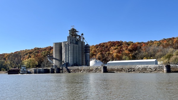
Here’s an example of the kinds of barge loading facilities we passed. Whatever is being stored in the silos is loaded onto barges for transport.

What I found really interesting about the barge loading process is the way the barge was out of balance as one end was loaded before the rest of the barge. Eventually, with an even load, the barge would level out.
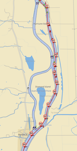
Both channels had deep enough water for us, but I chose the one that was marked — which is also the one the tows would take.
Just past there, the river split into two navigable channels — one marked and one unmarked. This took us around Hurricane and Diamond Islands. The river was very narrow in this area and I almost immediately regretted taking the marked channel because that’s where the tows would be traveling. Although the channel was relatively straight, there were some bends that could make passing a tow difficult. I watched my chartplotter for AIS icons anxiously, but there were none up ahead.
And then we were at Hardin, where we passed until a lift bridge that didn’t need to lift for us. Our destination for the night, Mel’s Illinois Riverdock Restaurant, was up ahead on the starboard side. I pulled alongside a rickety dock, Janet secured the lines, and I shut down the engine.

Here’s Do It Now parked at Mel’s dock.
My pups were pretty happy to get onto dry land.

Here’s the Nebo log for October 26, 2022. Download a PDF log file with more info. Track Do It Now on Nebo.
Mel’s Illinois River Restaurant
Mel’s was an interesting place. Although the dock itself was in decent condition, the ramp between it and land was almost scary — a rusty grate that I had to carry my dogs across. Still, it gave us easy access to land for the dogs and didn’t require any struggling with a windlass. That gave it high marks as an overnight stop.
Of course, the place is named for a restaurant because it’s basically a restaurant with a dock. It’s the kind of place that offers good, hot meals to the folks who live in the area, as well as the boaters — mostly Loopers — who come through. It would cost me $20 to park at the dock for the night and I thought it was a good deal.
La Principessa arrived a while later and tied up behind us. We went into the restaurant for dinner. I can’t remember what I had, but it was good. The pie for dessert, not so much. It was remarkably inexpensive.
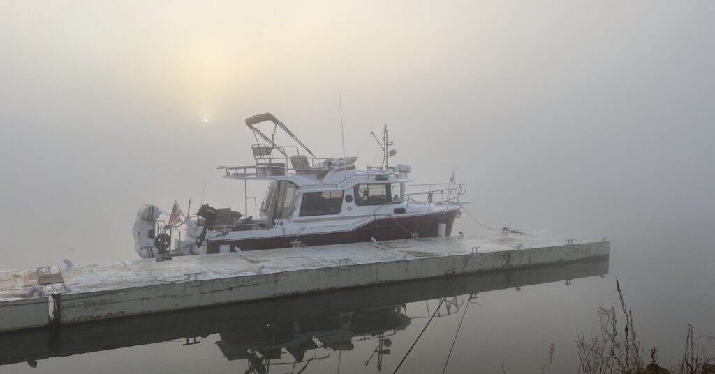
In the morning, the area was completely enveloped in fog — the thickest fog I’d been in for quite some time. It took a while to burn off. We were in no hurry to leave, though. We had a very short travel day ahead of us.
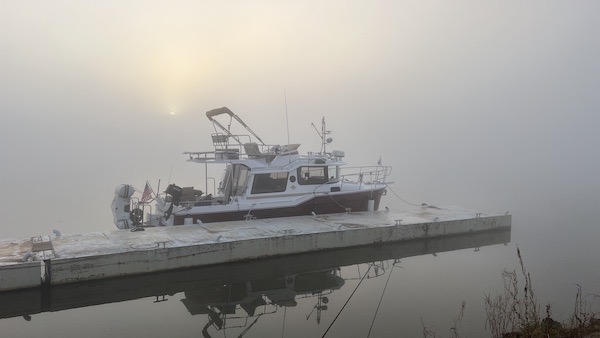
You can just see the sun rising in this foggy shot.
I walked into down with my pups and stopped at the Dollar General there. It’s weird, but dollar stores have really taken root in the midwest and, in some towns, become the primary source of merchandise. Dollar General has stepped up to the challenge and offers some fresh food items, including milk and eggs and even some fresh fruit and vegetables. This was a very well stocked store and I came back with orange juice, tissues, and a handful of other items.
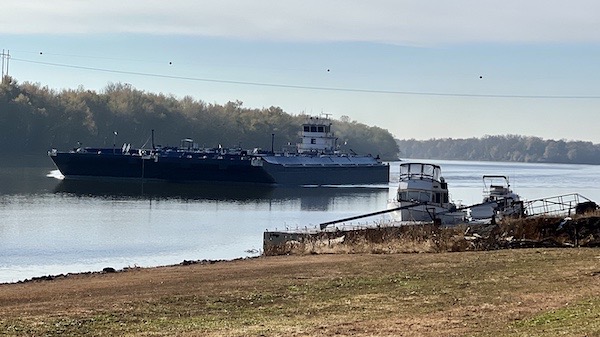
Walking back along the river, I got a photo of a barge passing by our boats at the dock. Pretty close, no?
I think we were waiting for Connie and Michael to be ready to leave but they were in slo-mo that morning. Michael was having some serious back problems that were nearly crippling him. They’d also planned to stop at Grafton so their day was almost as short as ours. Finally, when the fog lifted enough to travel and it didn’t seem likely that they’d be ready anytime soon, we cast off and continued down the Illinois River.
The Final Push to Grafton
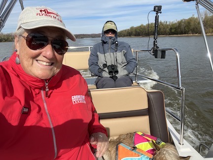
We rode up top on the command bridge as we left Mel’s. Do we look cold? It’s because we were. We didn’t last long up there.
We only had about 18 nm to go to get to Grafton. Grafton is the last stop on the Illinois River, which meets up with the Mississippi River about a half mile farther downstream.
After leaving Mel’s, the Illinois River continued pretty much as it had for the last 100+ miles. But now we were seeing homes, most of which were high on stilts, on one or both sides of the river. We passed through an area of lakes that we could not see and then channels from lakes and finally the Mississippi River entered from the starboard side. It was somehow exciting to see a channel joining the river, knowing that channel led right to the Mississippi.
And then we were there. I called Grafton Harbor Marina on the radio and was directed to a transient slip right in front of an oyster bar. After a few rough days on the water, I had arrived in heaven.
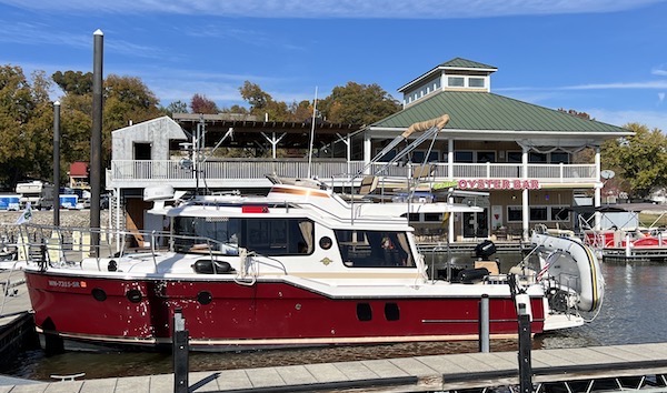
Do It Now parked in our slip at Grafton Harbor. What could be better than parking steps away from an oyster bar?
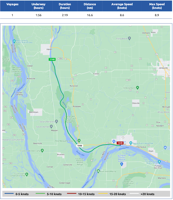
Here’s the Nebo map for October 27, 2022. Download a PDF log file with more info. Track Do It Now on Nebo.
We had covered just over 135 miles in 3 days.
(continued in At Grafton, IL)

Watched the video about the ferry. Reminds me of the two Shelter Island ferries on Long Island. One goes to the South Fork, the other to the North Fork. The similarity is how the ferries are the only way Islanders can get on or off the Island. I’ve been in line when an ambulance had to come through, when everyone has to wait. Which even New Yorkers are patient and gracious about.
Their ferries, though, are integrated, not a barge and a tug.
These were really interesting to me. The tow with the pivot point — genius! I really thought I got a photo but it’s not on my phone.
The crossings are relatively short, though. Maybe 10 minutes? I don’t think they operate on a schedule. I think they just go when the ferry is full or new cars stop arriving. I can see it being a challenging ride when the river is flooding; the current really picks up and there’s all kinds of floating debris.