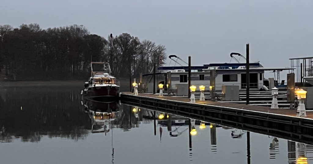
December 5, 2022: We get a late start out of Green Turtle Bay, find shortcomings in Garmin’s Autoroute feature, and get to our destination with barely enough light to see.
(continued from At Green Turtle Bay)
We left Green Turtle Bay Marina not long after Zip had departed with my check. It was 11:30 AM.
It was a late start and we had a lot of miles to cover. The weather had turned cold and dreary and there was rain in the forecast. I didn’t want to anchor out. I wanted to be at a marina, plugged in so I could run my electric heater and not have to worry about weak house batteries possibly not starting the boat.
I wanted to go to Paris Landing Marina but several people said it was closed. I called. The guy who answered said they were closed but open. He didn’t explain that. He said I could come. He told me where to go in case I arrived after 4 PM when he’d be gone. He told me where he’d leave a 50 amp to 30 amp adapter for me and the gate codes.
So that’s where we headed.
Garmin Autorouting Down Kentucky Lake
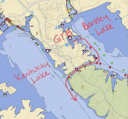
Here’s the chart for where we had to go that morning. I should add here that Kentucky Lake looks like a great place to spend a lot of time and it’s a real shame that we had to rush through it.
We were in Barkley Lake, which is fed by the Cumberland River. We needed to be in Kentucky Lake, which is fed by the Tennessee River. Fortunately, there’s a channel between the two near Green Turtle Bay. After leaving the marina, I pointed us that way.
There was low visibility, but not nearly low enough to prevent us from traveling. It was mostly low clouds that periodically drizzled rain on us. I did, however, turn on the radar and set it to display over a chart on one of my chartplotters. Heck, I’ve got the tools. It’d be dumb not to use them. Besides, it was a good chance to practice reading targets on radar.
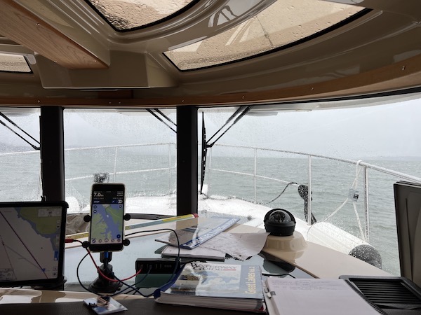
We had low visibility shortly after leaving Green Turtle Bay. But this was nothing compared to what we’d experience over the next few days.
I steered us through the channel that separated the two lakes. There was another boat maneuvering ahead of us; I later realized it was one of our neighbors at Green Turtle Bay getting some training in a new-to-him boat. It didn’t matter. As the visibility improved, I decided that it was time to experiment with the Garmin chartplotter’s Autoroute feature.
Autoroute is a feature where you tell the system where you want to go and ask it to plot a route for you. You can then engage the route and the boat drives itself. You just sit there looking for hazards and adjusting speed as desired. If a hazard comes up, you disengage the autopilot and steer around it.
Theoretically it should work. It has the charts, it knows where the marked channels are, it knows what the water depths are. Ideally, if there’s a channel, it should put you in it and keep you there. If there isn’t a channel, it should just plot a route that stays in water deep enough for your boat and keep you on that route.
That’s how it should work.
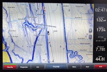
When I spoke to Garmin about this issue, they claimed it was because the chartplotter didn’t have enough detailed information to plot the course. I sent them this photo. It has plenty of detailed information about underwater contours and depths in Kentucky Lake.
So imagine my surprise when the Autoroute feature completely ignored the channel on the east side of the lake where that other boat was maneuvering and took us to the west side of the lake.
Now I’d read about a secondary channel on the west side of the lake. It was smaller and narrower and it was not the route the tows used. I figured the Autoroute feature was going for that. But after a while, I realized that it wasn’t. It was just driving in a straight line down the west side of the lake.
Where the chartplotter clearly indicated that there was shallow water.
After a while, I started seeing the shallow water. It showed up as white Danger buoys and places where the lake’s little waves broke over rocks in the middle of the lake. All this was on the chart, but the Autoroute feature was taking us dangerously close to them.
I turned off the autopilot and began working on a path that would get us back to the east side of the lake where the real channel was. It took a while, mostly because I had to drive slowly in places where the water was less than 5 feet deep. The last thing in the world I wanted was to scrape my hull or my prop on a submerged rock and be stuck out in the lake on a cold, rainy day.
Eventually, I got back into the channel. I wish I had a Nebo report to show where we went, but that was one of the few days I forgot to turn Nebo on.
The Race with Sunset
My notes for that day don’t talk at all about the Autorouting feature, mostly because I had my hands full dealing with it and couldn’t take a moment to jot down some notes. But my notes do indicate my worries about getting to Paris Landing before sunset.
Let me make something clear here: I have really crappy night vision. The two worst “incidents” I’ve had while driving happened at night. I avoid driving at night as much as possible, especially in unknown, poorly lighted areas. The idea of driving into this marina in the dark with no one there to direct us absolutely wigged me out. I had to get there before it got dark.
Sunset that night in Buchanan, TN was at 4:37 PM. (I just looked it up.) Last light was at 5:05 PM. (I looked that up, too.) My notes show my concern about our arrival time, starting at around 2 PM: “Clouds lifted, still 3 hours out.” That put our arrival time at 5 PM, just before the end of the light. That was cutting it too darn close.

Do you think I was worried about getting there on time? What I’ve discovered since then is that I get better mileage at 2800 RPM doing 13-14 knots than I do at 2400 RPM doing 8-9 knots. It’s not because the boat’s on plane — this boat doesn’t plane. I think it’s because a lot of the hull does get out of the water, thus reducing drag.
So, as my notes indicated, I kept increasing speed, trying to knock minutes off our ETA. I knew my ETA because I’d programmed the route into Aqua Map as a reference and had activated that so I kept getting updated ETA information.
Meanwhile, time wasn’t waiting for us. The light started fading long before sunset, mostly because the sky was so thick with clouds. By 3:30, it was getting harder to see channel markers ahead of us.
Finally, I saw the bridge and remembered the instructions I’d received when I called: “Go all the way up to the bridge but don’t go under it. Get into the channel on your starboard side going to the right. In the marina, park across from the fuel dock.”
By the time we reached the bridge, Alyse and I were struggling to see the channel markers, which, until the last two, weren’t lit. We’d call them out as we saw them. I slowed my speed to just above forward idle and crept along the channel. We saw the marina. Then we saw the fuel dock. Finally, we saw the long empty dock across from the fuel dock. I didn’t screw around looking for the best spot. I brought us into the dock right at the approach end.
It was 4:45 and drizzling again. It felt good to have the boat tied up for the night and shut down the engine.
Of course, it was just the beginning of December. The days would keep getting shorter for another two weeks.
At Paris Landing
I took my pups for a walk and fetched the electric adapter and gate code on the way back. We were exhausted from a long day with a stressful ending. One of us suggested ordering pizza and we did. Real pizza this time. It was delivered to the gate and Alyse went out to get it.
The marina was absolutely deserted. Sure, there were boats there, but there were no people. Or maybe that isn’t true. There was a very large boat — 60 feet or more — parked in a slip closer to the offices and there was a light on in there for a while. But we didn’t see anyone.
It was creepy.
I took my pups for one last walk on dry land before turning in for the night. I slept very well.
(Continued in Buchanan (Paris Landing) to Waverly, TN (Cuba Landing))
