April 7, 2022: Rain, dolphins, wind, tornado warnings, and a long day on the water.
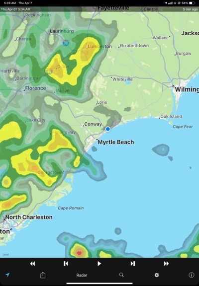
Here’s Thursday morning’s radar as it appeared on my iPad.
I woke before dawn on Thursday. My back still ached, but not as bad as the day before. As I made my coffee I realized that there was a heavy overcast outside. I checked the radar. It did not look good. Rain was bearing down on us from the west. Sure enough, before I finished my coffee it had already started raining.
Captain John didn’t seem phased by this. He was ready to move on and I certainly was, too. But I wasn’t looking forward to spending a day dealing with rain squalls, poor visibility, and high winds — especially since he planned to go all the way to Wilmington, NC that day — a trip that would take about 10 hours. To make matters worse, the storm was moving the same direction we were and the National Weather Service Wilmington NC office was talking about tornadoes.
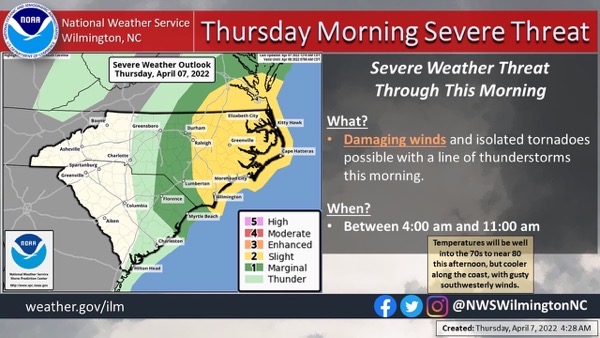
The only thing promising about this was that the weather should be past before we got there.
He’d originally wanted to depart at 7 AM, but delayed things a bit to see how the rain played out. It wasn’t a hard, driving rain, but it was the kind that gets you wet when you’re out in it, dealing with lines and electrical cords. I suited up in my rain suit and then stripped if off when he decided to wait. But when he decided to start unplugging, it was still off when the rain began.
In all honesty, I didn’t get that wet. It rained and stopped and rained and stopped. And then we were drifting away from the dock and Capt John was using those two engines to make a 180° turn and steer us out into the Intracoastal Waterway (ICW).
On the ICW
Because of the rain squalls, we had to cruise with the front window on the command bridge open. Some water came in, but not as much as I expected. I sat in back seat, which was slightly behind the captain’s chair with a clear view out the front. I stayed dry and, with my thick flannel shirt on, warm. There was no one else out on the water.
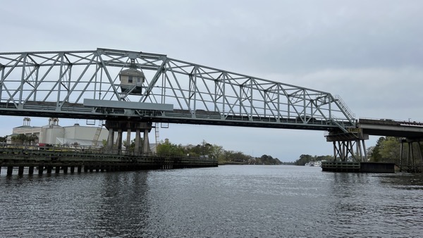
Here’s the swing bridge just north of Barefoot Marina — the one I’d walked over twice on Tuesday.
Gradually, the weather improved. The storm was slightly north of us and moving east. It passed us by with us moving slowly along the edges. Soon there were blue skies with the kind of white puffy clouds you remember from sunny days in your childhood.
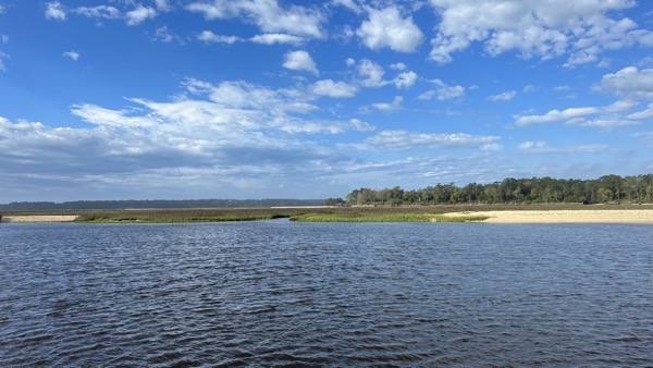
For a while, it was an absolutely gorgeous day.
We motored on with both engines set to 1100 RPM, giving us a speed between 6 and 8 miles per hour, depending on the current and wind. The ICW is tidal, like a river flowing alongside the ocean with inlets to let ocean water in or out depending on the movement of the tide. If you’re moving away from an inlet as the tide is coming in, you get a push from the current of the incoming water. But if you’re going the other way or the tide is going out, you get held back by that current. The current changes all day throughout the day depending on where you are in relation to inlets and which way the tide is moving.
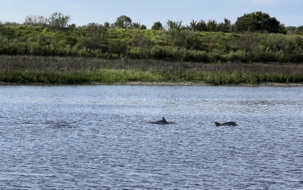
We started seeing dolphins (or porpoises?) very early on and saw them in a variety of places. It wasn’t the first time on this trip that we’d seen them, but we did see a lot that day.
The ICW, along this area, runs very close to the ocean, with only a series of narrow barrier islands separating it from the Atlantic. Yes, these are the same islands that get battered by hurricanes every few years. And yes, many of them are densely populated with homes packed along manmade canals that lead out into the ICW. I wonder about the logic of building homes in a place that’ll likely be under water in 20 or 30 years.
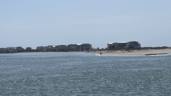
Lockwood’s Folly Inlet is a place known for shoaling. These homes are on the far end of Oak Island and appear to be built on sand.
There were plenty of bridges leading from the mainland to these islands but other that the one just north of where we’d started the day’s cruise, there was only one other that needed to open for us: the Captain Archie Neil “Poo” McLauchlin (Little River) Swing Bridge, which the locals apparently call the “Captain Poo Bridge.” We were a little far out when we called the operator and she told us she’d open “when you get closer and I get the cars off my bridge.” She must have been watching us, because a few minutes later, she sounded a horn and announced the opening on the radio, advising all listeners to stay clear of the bridge until it had stopped moving. We entered the No Wake area and Capt John slowed down. Their timing was perfect; he reached the buoys marking the safe zone just as the bridge stopped. We cruised through, John announced when we were clear and thanked the operator, and I watched the bridge close behind us. Can’t get any smoother than that: no waiting!
We watched the activity of other boats on Nebo, the app I use to share my location during my boat trips. Nebo is a free app and since it was pushed by the AGLCA, a lot of Great Loop boats use it. We could see two coming up behind us, and, after a while, we could physically see two large boats coming up behind us. Capt John got in touch with one of them on the radio and it turns out that they kind of knew each other. They stayed behind us for a while, always getting closer and closer, and then finally passed. A while later, the second boat in the pair opened up his engines and zipped past his companion. I don’t think he liked the slow cruising we were all doing.

Perfect Choice and Knot Flying passed us just past Lockwoods Folly Inlet.
Around lunchtime, we took turns making ourselves sandwiches in the galley. We were moving at a surprisingly good clip and would arrive in Wilmington a bit earlier than originally expected. But still, the trip would take all day.
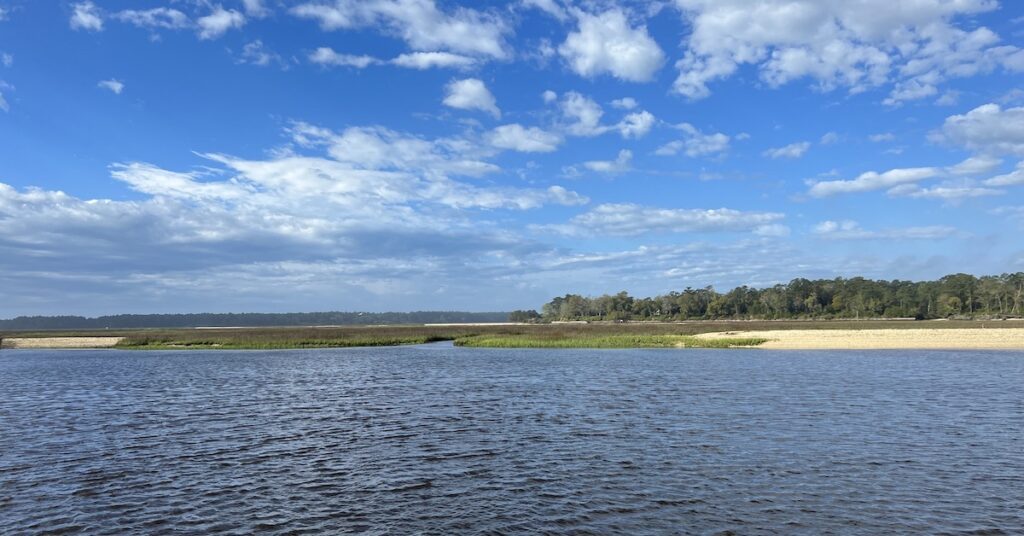
We continued on our way, never slowing, never speeding up. Although there were docks jutting out into the ICW, all the boats were on lifts so the small amount of wake we spread at 6 to 8 knots was not an issue. We passed homes and canals and inlets. We passed marinas and tall bridges. Dolphins surfaced for air. The wind picked up. The sky started clouding over again.
I got to drive a little. Not much. I think Capt John gets nervous when other people drive his boat. I get nervous when boat owners hover over my shoulder while I’m driving their boats.
We passed a huge dredging operation just before reaching Southport. It stretched for 4/10th of a mile along the seaward side of the ICW channel, with multiple tugs and barges. But even though it was midday on a Thursday, nothing was going on.
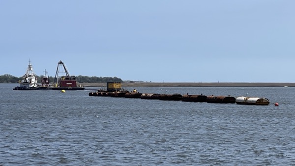
Here’s part of the dredging operation we passed just before Southport.
The Plan

We would be doing a lot of backtracking on the Cape Fear River.
We reached Southport at around 1:30 PM. Our plan in this area was a bit convoluted. Capt John had made plans for a vinyl installer to come and replace the weathered black vinyl striping on the top part of the boat — in other words, above the water line. He’d do that at a marina in Southport. But although it was Thursday, Capt John didn’t schedule him until Monday. And he scheduled a meetup with a friend of a friend at Bald Head Island on Tuesday. So with the four days we had to kill, he decided to go to Wilmington, which was about a four-hour cruise up the Cape Fear River (blue line). A side trip, he said. Trouble is, we had to go back down the Cape Fear River four hours on Sunday (green line), then make the relatively short trip to Bald Head Island (pink line), and then, eventually, go about two hours back up the Cape Fear River to continue on the ICW (purple line).
To my logically thinking mind, this made no sense. It would have made more sense to either get the work done in Southport first or go to Bald Head Island first, then Southport for the work, and then Wilmington for the side trip. It would have saved about four hours of cruising time with very little back-tracking.
But the plan was set and we were committed to it. So we passed Southport and headed up the Cape Fear River.
The Cape Fear River
The Cape Fear River separates Cape Fear on the east from the North Carolina mainland. It was an important route, especially during the Civil War, for confederate forces to get imported war materiel to Wilmington, where it could be transported on existing railroad lines to troops that needed it. Because of this, Union forces tried to blockade the mouth of the Cape Fear River, but because it had multiple outlets to the sea, it was very difficult to prevent blockade runners from getting in. To make matters worse, there’s a very lengthy shoal just outside the inlet that ships would commonly run aground on. (Fear of those shoals is supposedly what gave Cape Fear its name.) In general, it was a big fat mess, although the area museums go into a lot more detail than I could.
The river was much wider than the narrow ICW we’d been cruising on all day. The water had a little chop to it in the 16+ MPH wind, but Carver 36 rode smoothly right through it. The sky had clouded over completely and it was ominously dark to the west.
We continued north, following the channel markers closely. Although the river was wide, the channel wasn’t. It was wide enough for the large container ships and oil tankers that came up and down the river and would occasionally need to pass each other, but not much more. It also had a surprising number of bends and turns as it wound its way north; you really had to pay attention to those channel markers to keep out of shallow water.
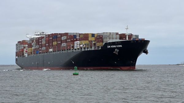
We encountered this Container ship shortly after starting up the river. He’s in the channel — we’re not. We wanted to give him plenty of room. Even so, cutting through his wake splashed up enough water to get through the porthole in my cabin — fortunately, on the other bunk.
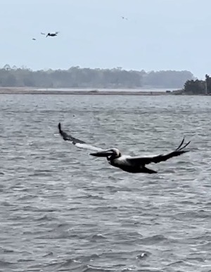
I think I could watch pelicans hunting all day long.
Pelicans gave us a real show. They’d glide past, about 20 to 30 feet over the water looking down. Then, when they saw something right below the surface, they’d fold their wings and drop out of the sky, splashing hard into the water and bobbing up almost immediately. If they gulped something down, I knew they’d made a catch. At various points along the way, dozens of pelicans were doing this, making huge splashes near and far.
We kept going. After a while, the radio started making a loud alarm sound. Capt John fiddled with it and a weather announcement came through from the Coast Guard. Severe thunderstorms. Quarter sized hail. Winds up to 60 MPH. All this was west of us but heading east. I looked at the radar on my iPad. It was bad and it was coming our way. The question was, would we get to Wilmington before the storm? Would it hit us before or after we docked? Or would it miss us completely? I didn’t know.
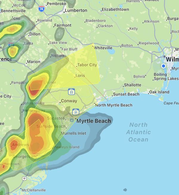
This is how things looked at about 3:55 PM. We’re the blue dot on the right; the storm was moving east.
We passed a few other large working boats along the way, including tugs and barges working on a dredging operation at a bend in the river. The dredging operation switched barges right after we passed.
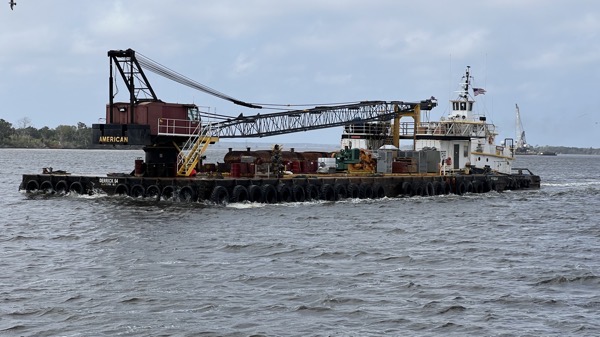
This looks like some dredging equipment being moved downriver.
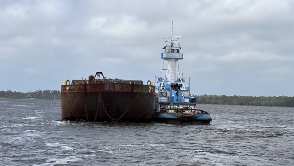
Here’s the empty barge waiting to be swapped in at the dredging operation.

Here’s the dredging operation on hold. The barge beside it is full, which is why it rides so low on the water. After we passed, they moved it out of the way and put the empty one in its place.
We kept going. There was another Coast Guard weather broadcast. The storm was still coming. The wind picked up and those threatening clouds were getting closer. We were the only pleasure boat on the water.
We eventually reached the shipping terminals on the outskirts of Wilmington. There was a lot of activity. An oil tanker was getting ready to pull out while several container ships were getting loaded or unloaded.

This oil tanker pulled away from the dock not long after we passed.
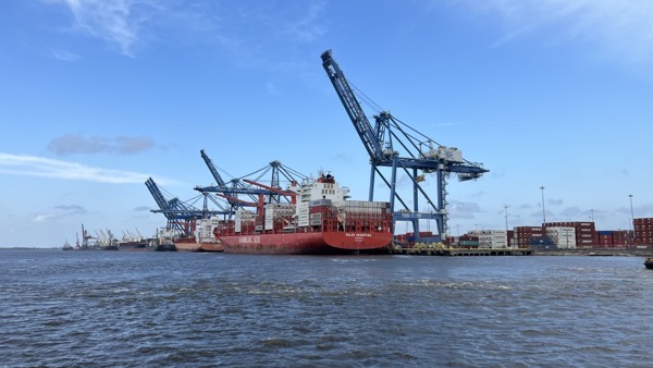
Container ships being loaded or unloaded at the port of Wilmington.
We passed the shipping terminals and continued upriver. We could see the general area where we needed to park along the city dock, but we weren’t sure exactly where to go. We used binoculars to scout things out. We went under a bridge with a noisy deck. I climbed down to the gunwales, dropped the fenders over, opened the gate, and prepped the midship line.
The wind was blowing hard when Capt John came in alongside the dock. I got down as soon as I could and fastened the line around one of the cleats. I went for the bow line and John came down for the stern. Then the boat was secured and he shut down. We’d had an audience — the dock was right at the foot of Market Street — and I don’t think our performance disappointed them.
We fastened a few more lines to keep us very secure and plugged in power. We were parked for the night.
The storm passed north of us a short while later with just a few random raindrops to let us know it was going by.
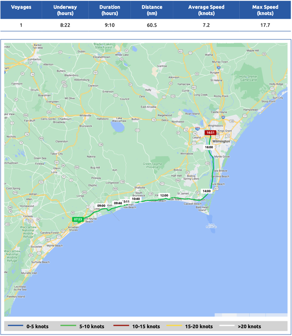
Here’s our Nebo log for April 7. It had been a very long day on the water: almost 9 hours.
In Wilmington
Although Capt John had set up pasta sauce in the slow cooker before leaving Barefoot Marina, neither of us felt like making the pasta to go with it. I felt like having a burger. He wasn’t very hungry at all. While he poked around on the dock to find the restrooms, I used Google Maps to find us a place for a bite to eat.
He returned to report that he’d met the owner of the marina just up the river a bit. That marina was closed because of insurance issues but despite the “No Overnight Docking” signs, the man assured us it was okay to park where we were overnight. He also gave John his card and told him to call if he needed anything. Nice!
Market Street, where we were parked, was very active with pedestrians. It was around 5 PM when we arrived and the place was vibrant with plenty of shops and restaurants that were still open. It was nice to have so much so close to us.
We wound up eating at a local sport bar called Rebellion NC, which was only about two blocks away. John ordered a beer that he really seemed to like. I ordered an ice tea and a burger. It was excellent. Afterwards, we walked over to Kilns Chocolates for ice cream. It was mobbed but we got served quickly enough. We sat on a bench on Market Street to finish them before going back to the boat.

At Rebellion NC. I had an excellent burger.
We were both exhausted and turned in not long after getting back. We’d do a lot of walking the next day.
I don’t know that I would go on such an adventure but I loved reading about yours
Thanks very much. There’s more to come.