I take a closer look at the NOAA marine weather resources.
This morning, I learned more about the National Oceanic and Atmospheric Administration (NOAA) National Weather Service (NWS) Marine weather services. How did I do that? Well, I finally took a good look at them.
I knew a lot about NOAA’s Aviation weather services, but admittedly rarely used them. As a helicopter pilot, I’m normally doing short local flights — less than 50 miles — at altitudes far below the fixed wing aircraft that those services are designed for. Do I need to care about High Level Prog chart data when I’m flying at 700 feet above the ground (AGL) from Wenatchee to Chelan on a scenic route along the Columbia River? No. How about icing over the Cascades and moderate turbulence at FL20 (20,000 feet altitude)? Nope. So I get my weather information when I plan my flight with ForeFlight, which taps into NOAA/NWS data, focusing on the weather information that may affect my flight — mostly current and forecasted weather at area airports. I then use NWS hourly forecasts to learn about forecasted surface wind, temperatures, and storm activity along my route.
But yesterday, I took a closer look at NOAA’s Marine weather product. It works differently from what I was used to, but I was delighted to see that after enough clicking, I could zero in on an area and get a familiar looking forecast page with boating specific information such as wave heights. And, as you might imagine, there were links to special forecast information, including small craft advisories.

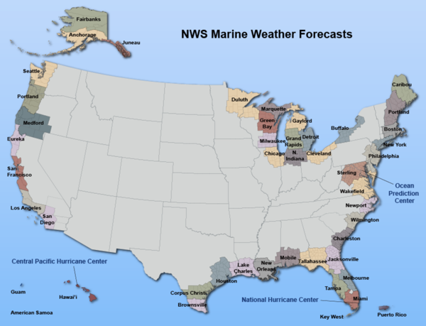
The home page for NOAA/NWS Marine forecast page offers a clickable map. Click the area that interests you to zoom in.

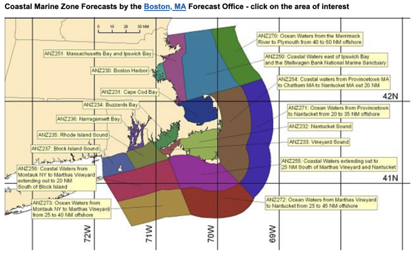
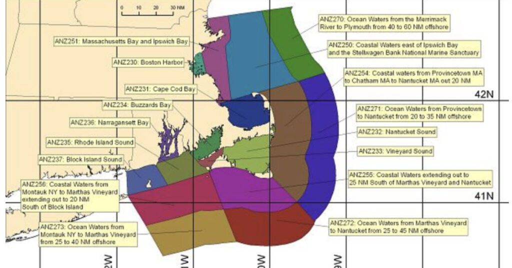
When I clicked on the New England area of the map, it zoomed in to this view. Each area I can click is a different color. Yellow boxes describe what each area covers.

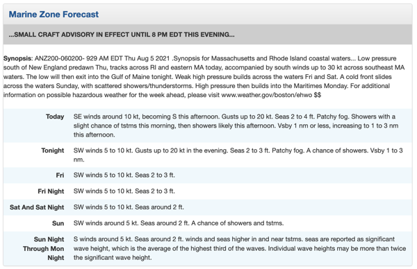
I clicked the green area for Buzzards Bay, where Nano is currently hunkered down at a marina, likely waiting out the weather. Here’s the forecast that came up. I can click the Small Craft Advisory link to learn more about where and what that advisory is. It’s pretty obvious, however, that the advisory warns about high wind, rain, and low visibility.
Now if you’re a mariner and you’re reading this, you must think I’m some sort of idiot. Of course this weather is available. But have patience with me. This is all brand new to me and, as a weather nerd, I’m always excited to learn about new resources.
I’m also serious about learning more about marine weather. I had seen the Boat US Foundation Weather for Boaters course and considered taking it. Now — with Nano facing weather just 3 days into its trip — I’m thinking that I’d be an idiot not to take it before I join the captain and other crewmember on Nano.
Why did I hesistate? Well, I’ve spent the past 20+ years living in desert environments where weather is seldom an issue. It has likely made me weather complacent. I need to get over that and get prepared. What I learn in this course can be reinforced on our journey and, hopefully, locked into my brain.


