March 27, 2022: We continue north up the Intracoastal, through a mostly uninhabited area.
Sunday morning was downright chilly — below 50°F! — but bright and sunny with very light winds.

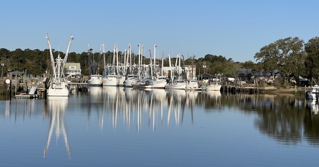
I shot this before dawn on the way to the Marina’s single restroom. This is a shrimp boat fleet based at McClellanville; shrimp season starts in May so they were idle.
Making Looper Friends
I was just coming back from the rather unsatisfactory restroom over the marina office when I noticed that Island, the boat behind us, was preparing to cast off. Island was about the same size as us, with a husband and wife team on board. I offered to help them cast off. The husband, Larry, seemed grateful and asked if I’d push out the bow; they were almost wedged between us on their bow and another large boat on their stern. I think he was (rightfully) concerned about hitting one of us.
His wife, Lou, came out and handed me a boat card. That’s a business card that boaters have that usually has a photo of the boat, the boat’s name, the owner’s/cruiser’s name(s), and contact info or blog links. I hurried back to Carver 36 and asked John for a card. He was still in his bunk, reading email, but he hurriedly produced a card I could hand back to Lou.
Larry climbed up into the bridge and started the engines. He’d already cast off the bowline line and the boat’s nose was drifting out to the river quite neatly, all by itself. By the time Lou had cast off the midship line, the bow was clear of us and moving out into the river. I can only assume the tide was going out and taking the boat with it. I tossed the stern line to Lou and they moved away, turning to point downriver. I waved good bye.
A while later, I got a message from them on Nebo, thanking me for the help. We’d continue to communicate via Nebo for the next few days.
Leaving McClellanville
It didn’t take us long to prepare for departure. It’s usually a matter of unplugging power and stowing the lines on the bow and then planning for casting off.
This would be the second time I was casting off with John and I don’t think he trusted me very much yet. I had seen how Larry cast off so easily, using the river/tide current to push the bow out and turn around midstream so I figured we’d do the same. But John hadn’t seen Larry’s easy departure. He wanted the stern untied first and then the bow and then the two midships lines. I think he was worried about my ability to get back on the boat. And rather than just go up to the bridge and trust me to do the lines, he worked with me and made sure I was on the boat before he maneuvered away.
The maneuver was not what I expected. We basically went out into the river stern first and then turned around. It worked, though, and we were soon pointed in the right direction and heading out toward the Intracoastal Waterway (ICW).
Along the ICW
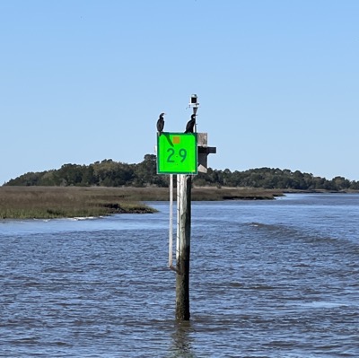
Almost every marker along the way had at least one bird perched on it.
Our cruise along the ICW got off to a slow start. We were battling the tidal current that was pushing past us and, for a while, the best speed we got was about 6 knots.
There wasn’t much of interest on either side of the boat. Once we left the McClellanville area and its handful of homes and docks on the ICW, we were in a sort of wilderness, with marshland on the starboard side and mostly undeveloped land to port. There were small buoys marking crab traps on either side of the channel, mile after mile. We saw two bald eagles in flight along the way. And we were passed by a handful of boats in both directions.

Don’t let this photo fool you. This boat was 65 feet long, almost a full 20 feet longer than us. Judging by the speed he caught up to us and then departed after a slow pass, he wasn’t concerned at all about fuel economy.
I was at the helm when we crossed a number of small rivers that flowed from the mainland out through the marsh and into the ocean: the South and then North Santee Rivers and Minim Creek. It was necessary to pay close attention here since it would be easy to make a wrong turn and head up or down one of these waterways.
Capt John showed me how to use the navigation system and autopilot heading hold feature to stay on a course he programmed in and then how to program the navigation system. Unlike the last boat I was on during my Great Loop 2021 trip, Carver 36’s navigation system could not drive its autopilot so there was no sense in programming a route. Instead, we used the heading hold feature to stay on a visual course; we really didn’t need the navigation system to tell us where to go.
After these rivers, the ICW became very canal-like, cutting through land without the need for markers to warn about shallow water or mark the channel. It reminded me a lot of many parts of the Erie Canal.

This canal-like portion of the ICW is labeled the “Estherville Minim Creek Canal, Western Channel” on Aqua Maps.
It also got very cold up in the breeze. We’d opened a lot of the canvas to keep the wind blowing through after dealing with some carbon monoxide detector warnings that were likely caused by a back draft bringing engine exhaust into the otherwise closed up cockpit and command bridge. Although it was a beautiful sunny day, it was downright cold and the wind blowing through didn’t help. I spent some time down in the cabin before coming back up wearing a scarf and a jacket.
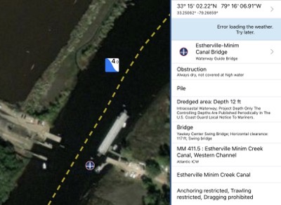
Here’s the satellite image on Aqua Map with the Waterway Guide info behind it for that weird floating bridge.
Right before the ICW dumped us out into Winyah Bay, we reached what Waterway Guide said was a bridge. It was actually some sort of swinging barge that created a floating bridge across the ICW. There were cars parked at both sides but we didn’t see any people. Part of me wanted to see it in action while the other part of me just wanted to get to our next stop already so I could get out of the cold.

Here’s a photo of one side of the floating bridge setup. I suspect the barge just pivots out and locks into place on the other side of the channel. It would have been interesting to see in action.
It was around then that I noticed we’d almost caught up to Island, which was out a mile or two ahead of us in Winyah Bay. I wondered whether they’d gotten stuck on the south side of that weird bridge. I used Nebo to tell them we were catching up and they reported that they’d caught a crab trap and “took a dip.” Going in this water in this temperature to get a crab trap off a prop did not sound like fun.
Coming into Georgetown
After motoring in the largest body of water we’d been in since leaving Charleston Harbor and following an extremely well-designed navigation range in toward Georgetown, we made the turn into the Sampit River. Capt John tried to call Hazard Marine on the phone and on the radio but there was no answer. So, not knowing which side we’d be tying up on, he told me to drop all the fenders, which I did.
John made a slow approach to a floating dock where a number of very large boats were tied up. A woman stood waiting for us at the far end, which was wide open. John pulled up to her and I tossed her the midship line (as I’d been instructed). She, John, and I tied the four lines, securing Carver 36 to the end of the dock.
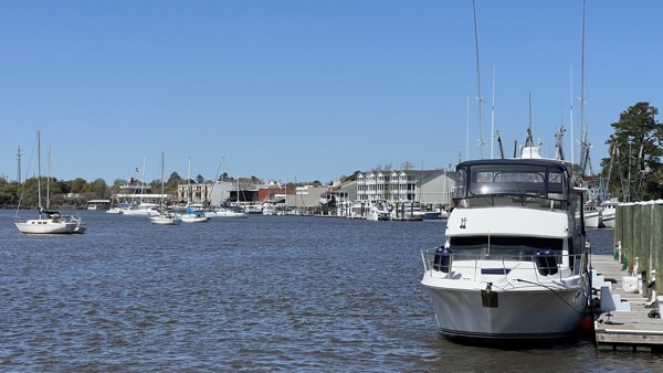
Here’s the view toward town off the bow of Carver 36. Hazard was the first of several marinas and public docks on the river in town. As you can see in this photo, the wind was making the water choppy that afternoon.
As we tied up, I noticed Island heading out of town. It turns out that the marina they were headed for was full and they decided to continue on their way.
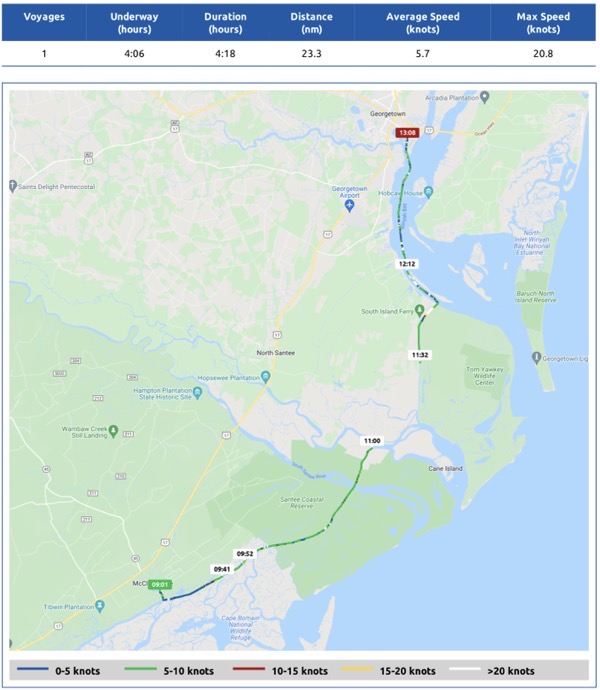
Here’s the Nebo log for the day. For some reason, Nebo cut out and did not track us for part of the trip.
Getting Acquainted with Georgetown
Susan, the dockmaster, checked us in at the office, which was also a marine store with the basic things you might need for a boat. She gave us the password for the excellent wifi network and combinations to the bathrooms, each of which had its own shower. She told us how to get to town, which was a short walk away, and even told me where I might find some dessert.
We had lunch on the boat — soup and half sandwiches — and then headed into town. It was a very pleasant walk with the same kind of tree-lined streets and flowering bushes we’d seen the day before in McClellanville. Although Hazard Marine was the first marina in town and the farthest away from shops and restaurants, it was only about four blocks into town. Along the way, we passed a rooster and some hens scratching in the dirt and grass alongside the road.
It was a Sunday, so as I expected, most shops were closed. We stopped in at the restaurant where I was told I could get dessert and I left with a piece of chocolate pecan pie in a to-go box. Then we walked up one side of Front Street and down the other, noting various restaurants and shops that we might want to visit before we left town later in the week.

I didn’t even realize that Orion was visible in the night sky until I looked at this photo. The only source of lights were those on the marina office building.
We walked back to the boat and spent the rest of the afternoon just taking it easy. I read and napped. We had leftover chicken and pasta for dinner. Sometime around sunset, the wind finally died down, although it was still very chilly. John put on the heat.
Before hitting the sack, I hit the showers. The water was good and hot and the room was even heated. And, oh, so much cleaner than the bathroom back at McClellanville!
On the way back, I stopped to take some photos of the marina and boats at night. The night sky was full of stars that reflected into the dead calm water. I came to the conclusion that my iPhone 13 Pro takes better night photos handheld than my Nikon on a tripod.
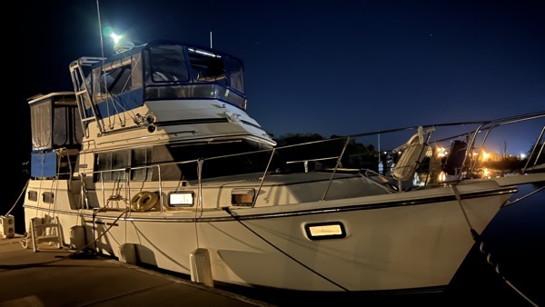
Carver 36 at night at Hazard Marina in Georgetown.
